Trick or treat? 70s today across Mass. before colder air returns on Halloween
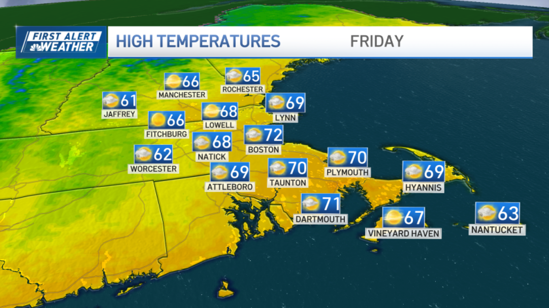
It’ll be hard to top yesterday’s weather but today is up to the task.

After a few passing morning clouds (and a rather balmy start compared to the last couple of mornings), we’re back to full sun. Southwest winds turn northwest and usher in the 70s all the way to the coast, Cape and Islands.
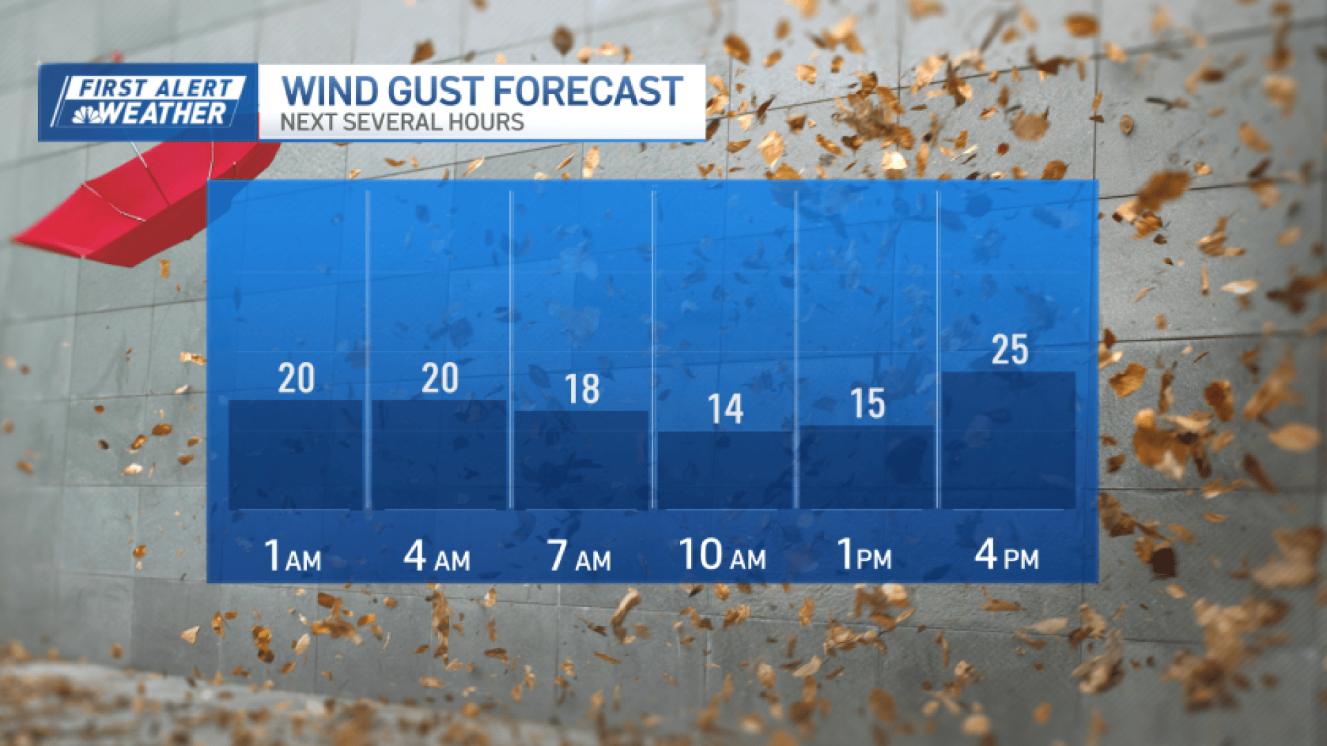
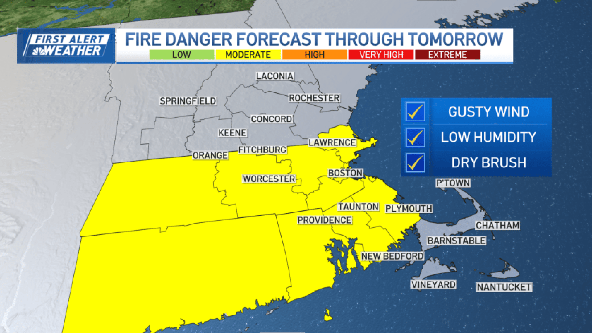
With the recent dry spell (now on 13 days without any rain), lots of “leaf litter,” and that brisk wind, fire danger will be elevated today across much of southern New England.
Beware of any local burning and/or nighttime bonfires.
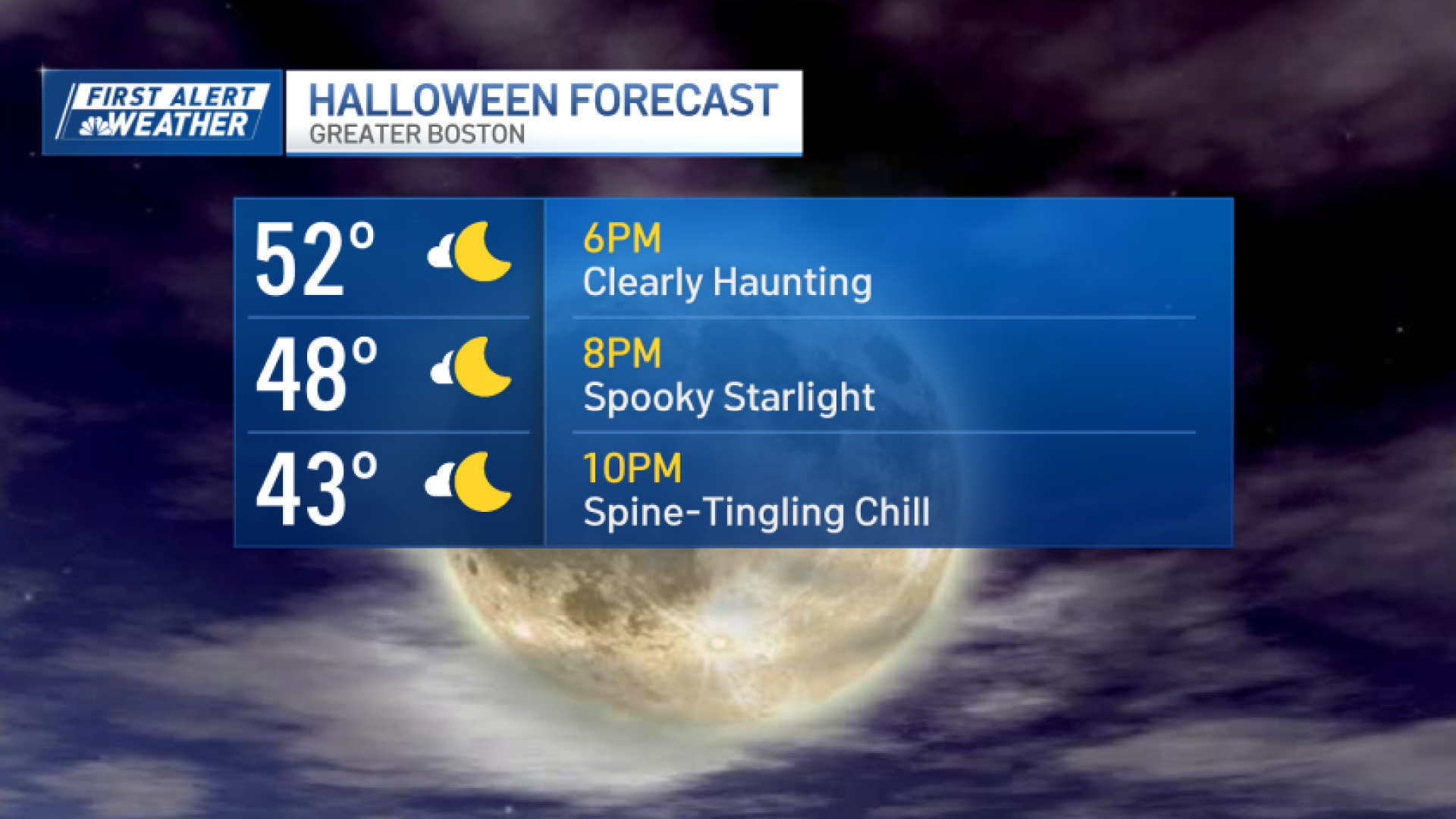
Colder air will return tomorrow morning and afternoon. We’ll start in the 30s and 40s and only rise to the low and mid-50s.
Temperatures drop quickly after sunset, with general 40s into the evening for the trick-or-treaters. Later at night, we’ll fall to the 20s and 30s for the late-night Halloween revelers. All-in-all, not a bad holiday this year (And it beats the pre-Halloween snowstorm in 2020!)


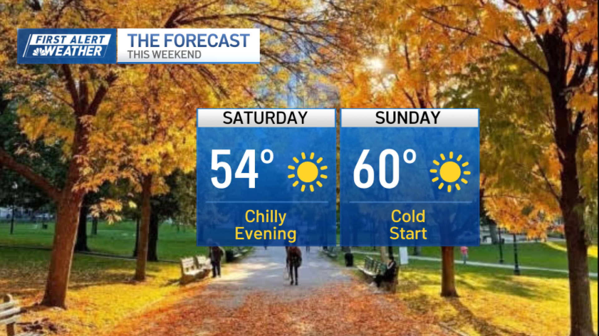
We’re sunny right into early next week, with temperatures mounting another comeback to 60 on Sunday and the mid-60s Monday.
Our next chance of rain is likely by Thursday. And while most of the physics-based models had this rain arriving Tuesday early this week, AI models kept the sun rolling and held it back until late week. The machines are indeed learning…
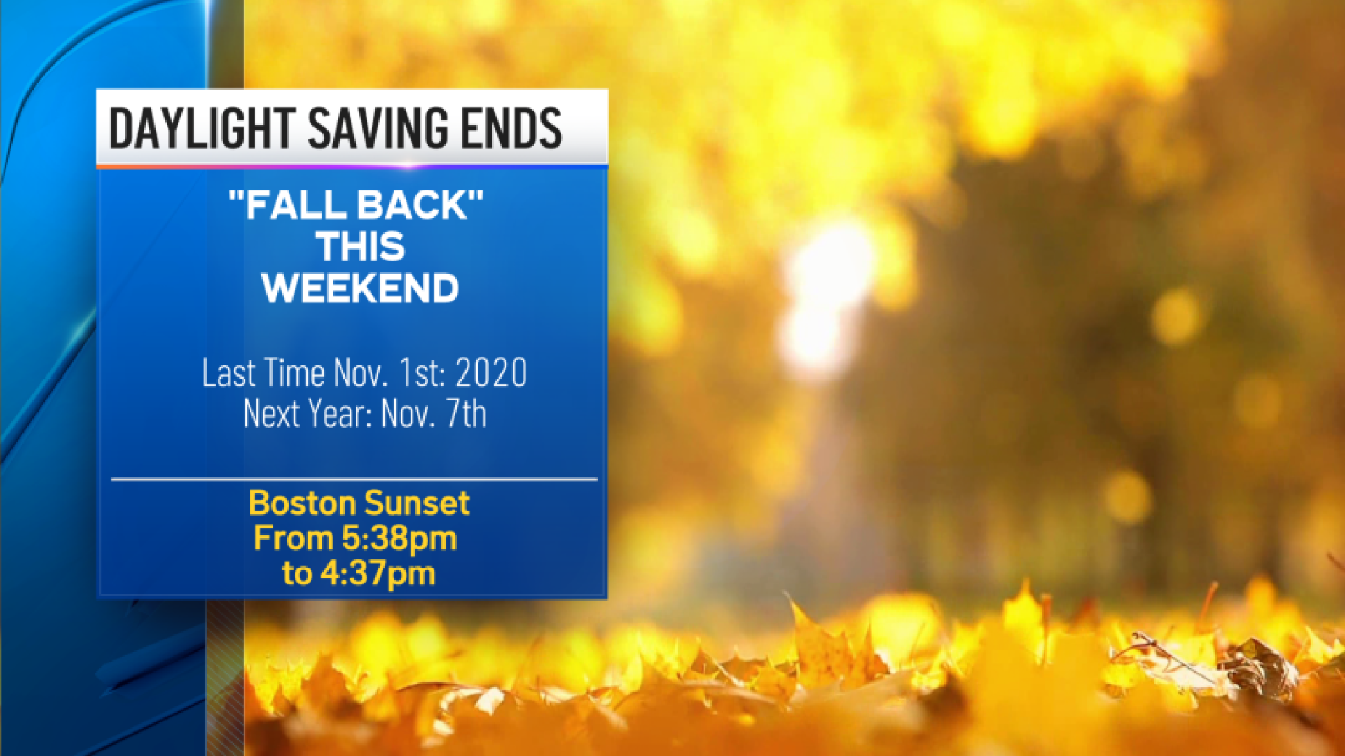
Clocks turn back while we’re sleeping Saturday night. Have a great Halloween and enjoy the weekend!
Ver nota original ↗
¿Querés un resumen rápido de esta noticia, hecho por nuestra IA?