
Showers & storms return for Halloween
NEW ORLEANS (WVUE) - After 27 days without any measurable rain at the New Orleans International Airport, that dry stretch will come to an end today as scattered rain moves in.
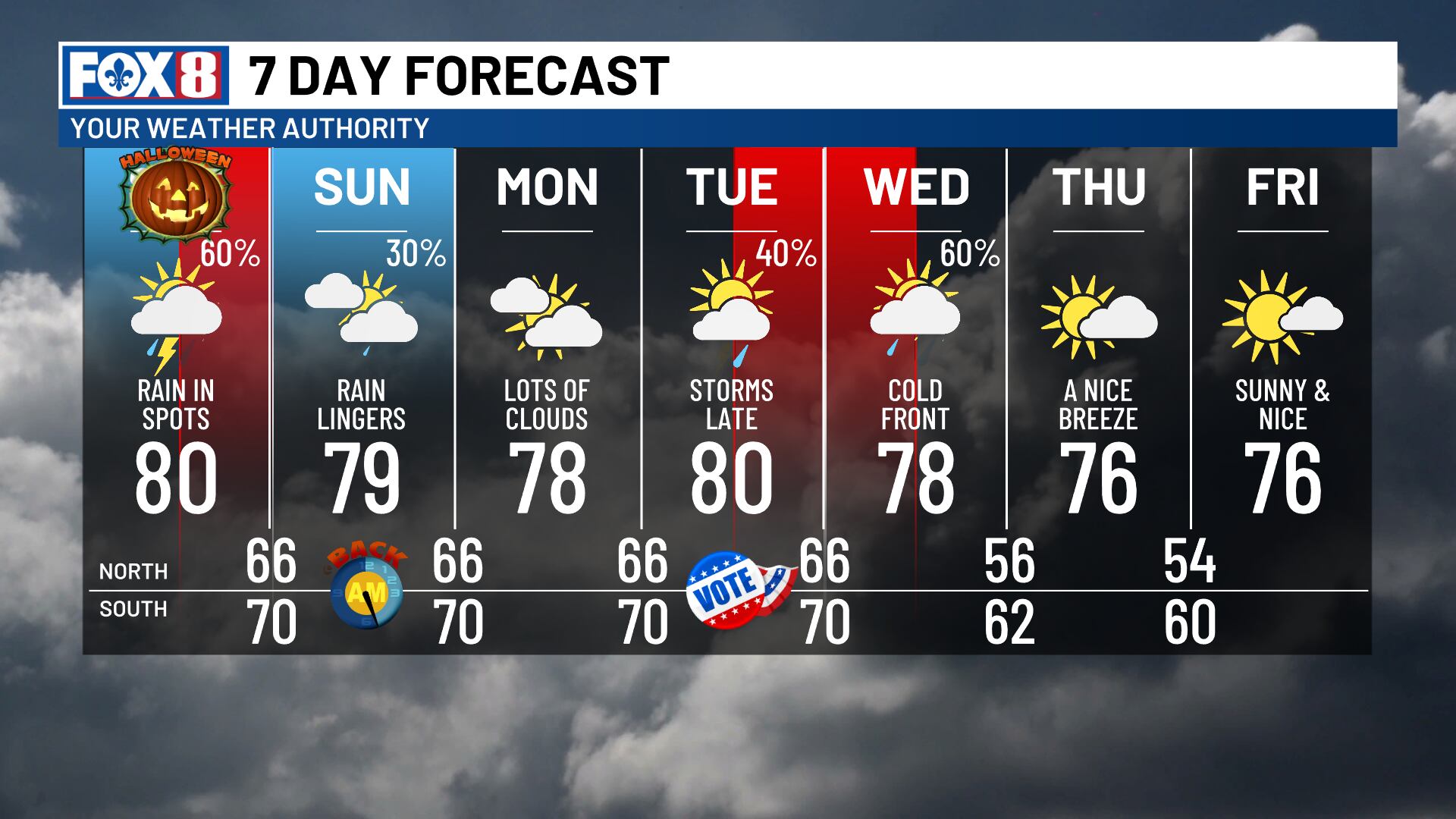
Halloween morning will start out mostly cloudy and dry, which is good news if you’re getting an early start. As a disturbance pushes in from the west, though, scattered showers will develop by midday and stick around through the evening hours.
Most of the rain will be light to moderate, though we may see a few isolated storms that produce some heavier downpours. You’ll have plenty of dry windows throughout the day, but if you’re planning to be out trick-or-treating, you should expect some rain to be in the mix. Keep an umbrella handy just in case.
Temperatures will reach around 80 degrees today, then drop to the lower to mid 70s this evening.
Sunday looks to bring highs in the upper 70s with a few showers lingering into the day.
We’re keeping a close eye on a cold front moving in next week that could bring some showers to Election Day before it arrives.
This front looks to move through Tuesday night into Wednesday morning, bringing a round of rain and storms. Some of those storms could turn strong to severe, which would be our first significant severe weather threat of the season.
Once that front passes through, we’ll dry out for the rest of the week with highs settling in the mid-70s.
See a spelling or grammar error in our story? Click Here to report it. Please include the headline.
Subscribe to the Fox 8 YouTube channel.
Ver nota original ↗
¿Querés un resumen rápido de esta noticia, hecho por nuestra IA?


