Warm & humid before a midweek front
NEW ORLEANS (WVUE) - This week starts off cloudy with higher humidity and small rain chances, before a weak midweek cold front sweeps through.
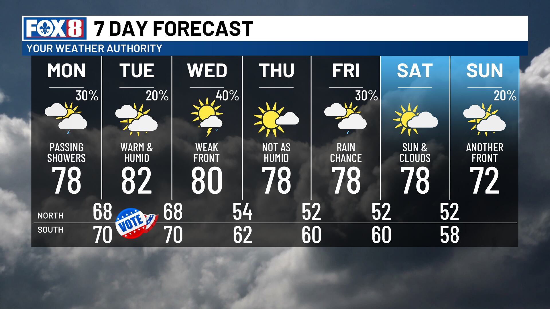
Monday brings upper 70s with clouds sticking around throughout the day. You might notice a few passing showers moving in from the southeast, but the chances remain low.
Election Day will also be mostly cloudy with a slight chance for a few passing showers or an isolated storm.
A cold front will be approaching from the northwest, but it likely won’t move through until Wednesday, so your voting plans should stay on track.
A few showers are possible along the front Tuesday night into Wednesday morning as the system gets closer. Although this front is likely to bring strong storms to western Louisiana, they’re not expected to keep their strength once arriving in our area. That means severe potential has lowered quite a bit, which is good news for us.
The front will continue steadily passing through the area on Wednesday, exiting by Wednesday afternoon. A few isolated storms can’t be ruled out during peak daytime heating, with its exit.
Behind the front, you’ll notice much lower humidity with small rain chances returning by Friday. Another front will arrive for the weekend, reinforcing that lower humidity and possibly dropping our highs into the lower 70s by Sunday.
See a spelling or grammar error in our story? Click Here to report it. Please include the headline.
Subscribe to the Fox 8 YouTube channel.
Ver nota original ↗
¿Querés un resumen rápido de esta noticia, hecho por nuestra IA?