A wet and chilly start to our Tuesday across the Denver Metro Area
It's a chilly and wet start to the day as a storm starts to clear out of the region. The rain briefly switched to a little snow across parts of the Front Range, but it's too warm to see any of it sticking. You will find some sloppier conditions over the high mountain passes, with some light snow lingering through early morning.
Skies will continue to clear through the morning hours, with more sunshine this afternoon. Temperatures will climb into the mid- to upper 50s...so it will be just a few degrees below normal for early November.
A seasonal start to NovemberWinds will remain breezy, with gusts of 20-30 mph possible across the plains and that will make it feel a touch cooler at times. Today will actually be the coolest day of the week. We'll see some warmer weather return across the plains as a ridge of high pressure starts building back into Colorado.
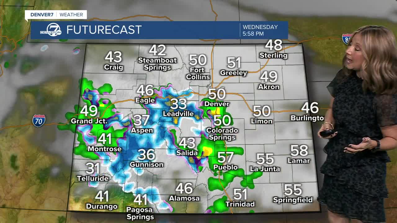
Another weak storm system will slide across the state Wednesday, bringing a renewed chance for mountain snow and a few rain showers across the plains. The best opportunity for precipitation looks to be across the southern mountains, including areas along the I-70 mountain corridor and south. Snowfall amounts should be light, though.
The Denver Metro Area will be on the northern edge of this system, but there is a chance that we will see some wet roads for the Wednesday evening commute...especially south along the Palmer Divide.
After that, high pressure takes over again, bringing near-average temperatures in the upper 50s to low 60s and mostly dry weather through the weekend.
DENVER WEATHER LINKS: Hourly forecast | Radars | Traffic | Weather Page | 24/7 Weather Stream
Click here to watch the Denver7 live weather stream.
Ver nota original ↗
¿Querés un resumen rápido de esta noticia, hecho por nuestra IA?