Rain returns to Carolinas at end of workweek: Forecast here
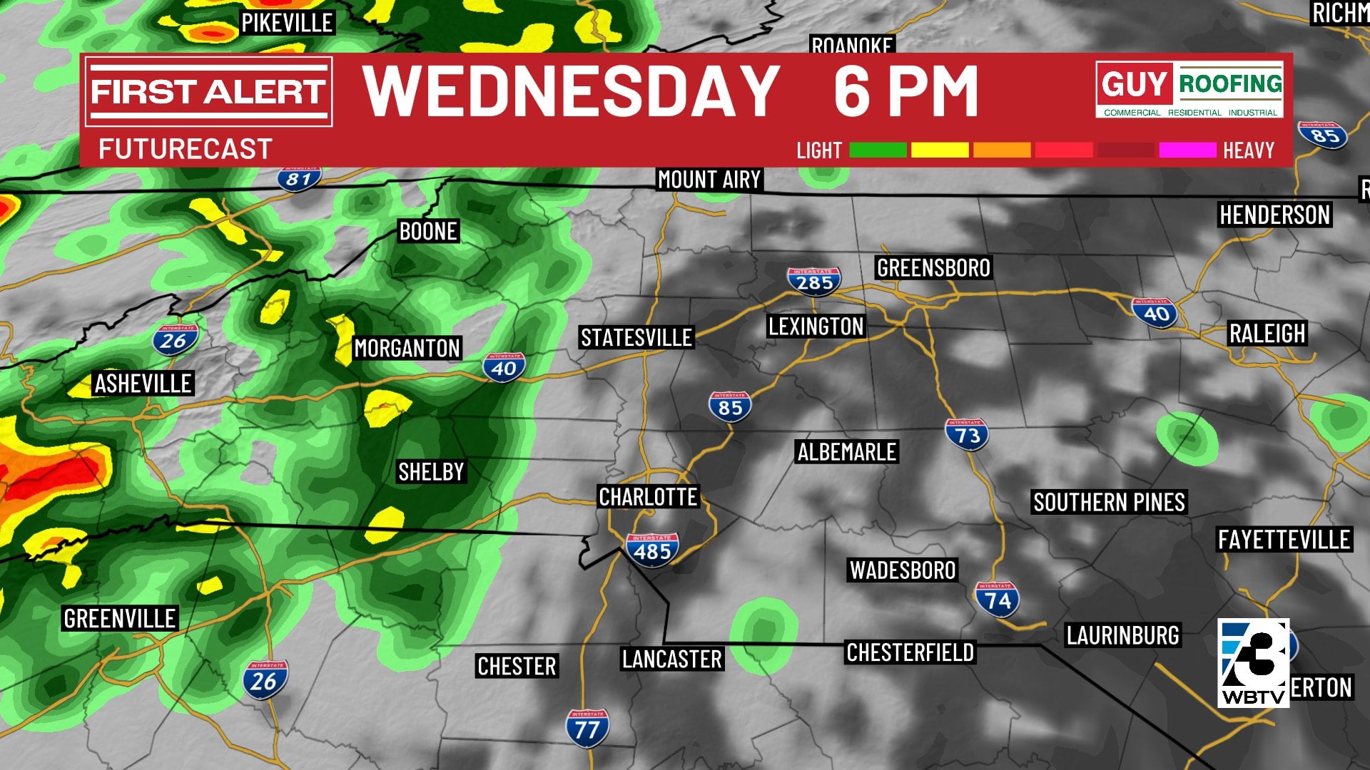
CHARLOTTE, N.C. (WBTV) - Wednesday will be mostly cloudy, warm and humid with highs in the middle 70s around Charlotte.
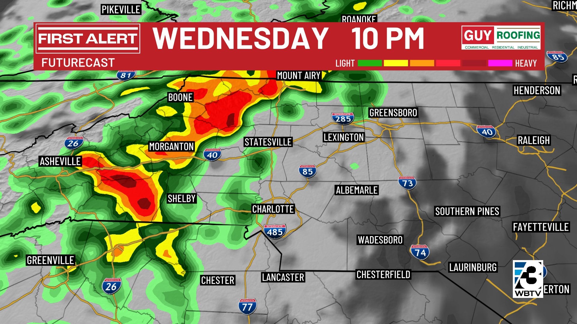
The best chance for rain Wednesday will be in the mountains (lower 60s there), spreading into the foothills during the late afternoon hours. Overnight, rain will moving into Charlotte and the rest of the Piedmont.
Rain returns
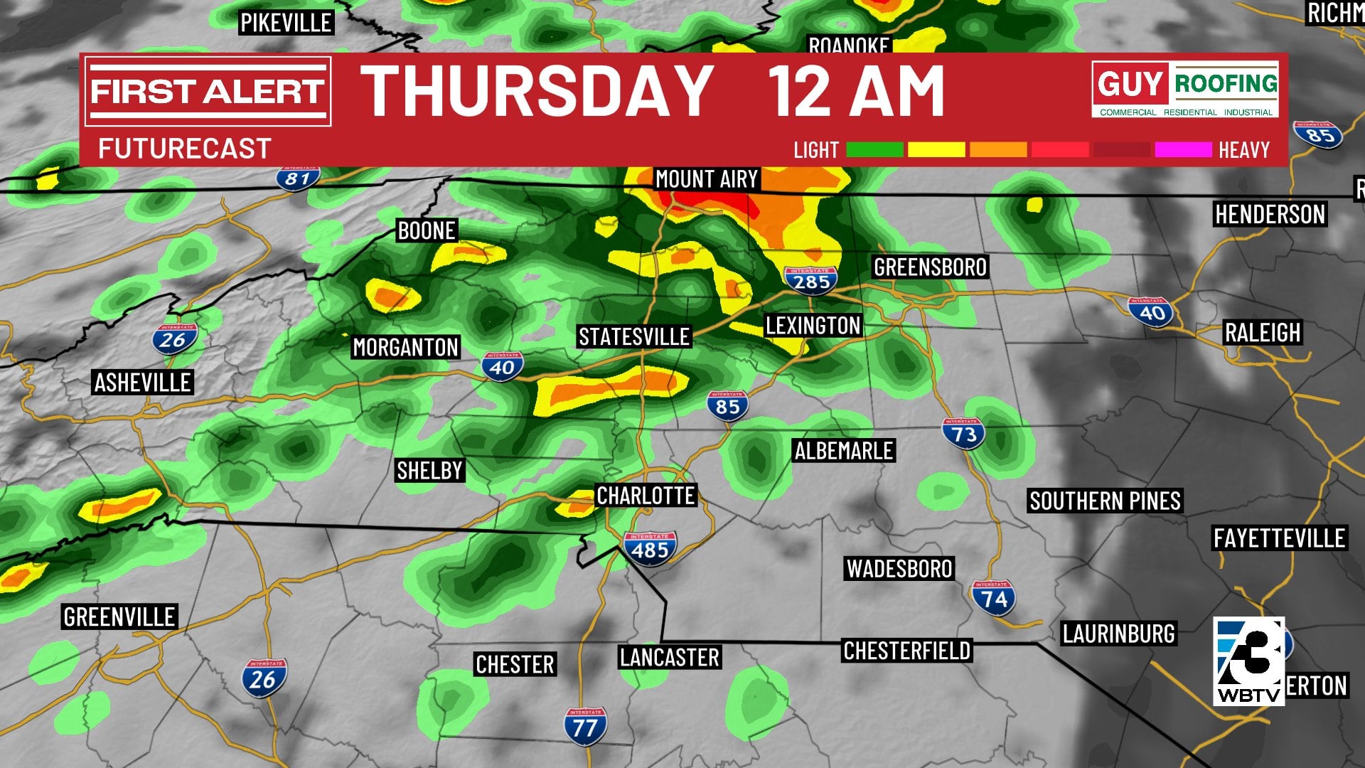
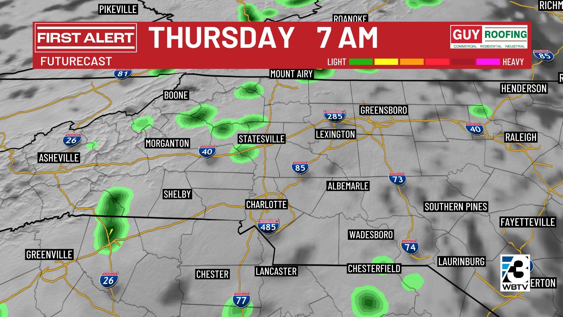
A band of showers and even a couple of heavier thunderstorms will move across the WBTV viewing area Wednesday night before ending quickly by daybreak Thursday.
After the bulk of the rain pulls out early Thursday morning, afternoon temperatures will rebound to the middle 70s under partly sunny skies, but there might still be a few pop-up thundershowers during the afternoon hours.
There may be another round of rain and thunderstorms late Thursday night into early Friday morning, but the trend is for this band to track east of the Charlotte metro area. If that trend continues, we may be able to lower Friday’s First Alert.
Nice weekend ahead
A clearing trend will kick in Friday and there will be plenty of sunshine to go around through the weekend.
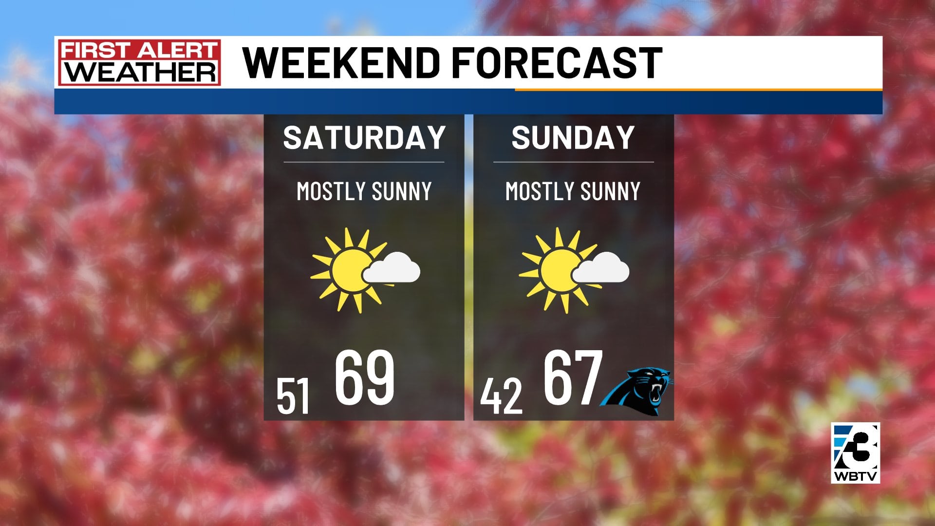
Friday will still be warm with highs again in the middle 70s before numbers drop back to more seasonal levels in the mid to upper 60s both Saturday and Sunday.
Forecast at a glance
- Wednesday: Mostly cloudy, mostly dry, warm, muggy 70s
- First Alert: Rain tonight/early Thursday AM
- Friday: Rain trending east, stays warm in the 70s
- Weekend: Mostly sunny, dry, seasonal cool 60s
Download the free WBTV Weather app on your mobile device to get weather alerts and the latest forecast on the go. You can also catch the latest forecast on WBTV’s streaming app -- find it in the app store on your smart TV or streaming device.
Ver nota original ↗
¿Querés un resumen rápido de esta noticia, hecho por nuestra IA?