Rain finally returning to the Carolinas: Latest forecast
CHARLOTTE, N.C. (WBTV) - Charlotte has only picked up 0.03″ of rain over the last 23 days, but that mostly-dry stretch is coming to an end.
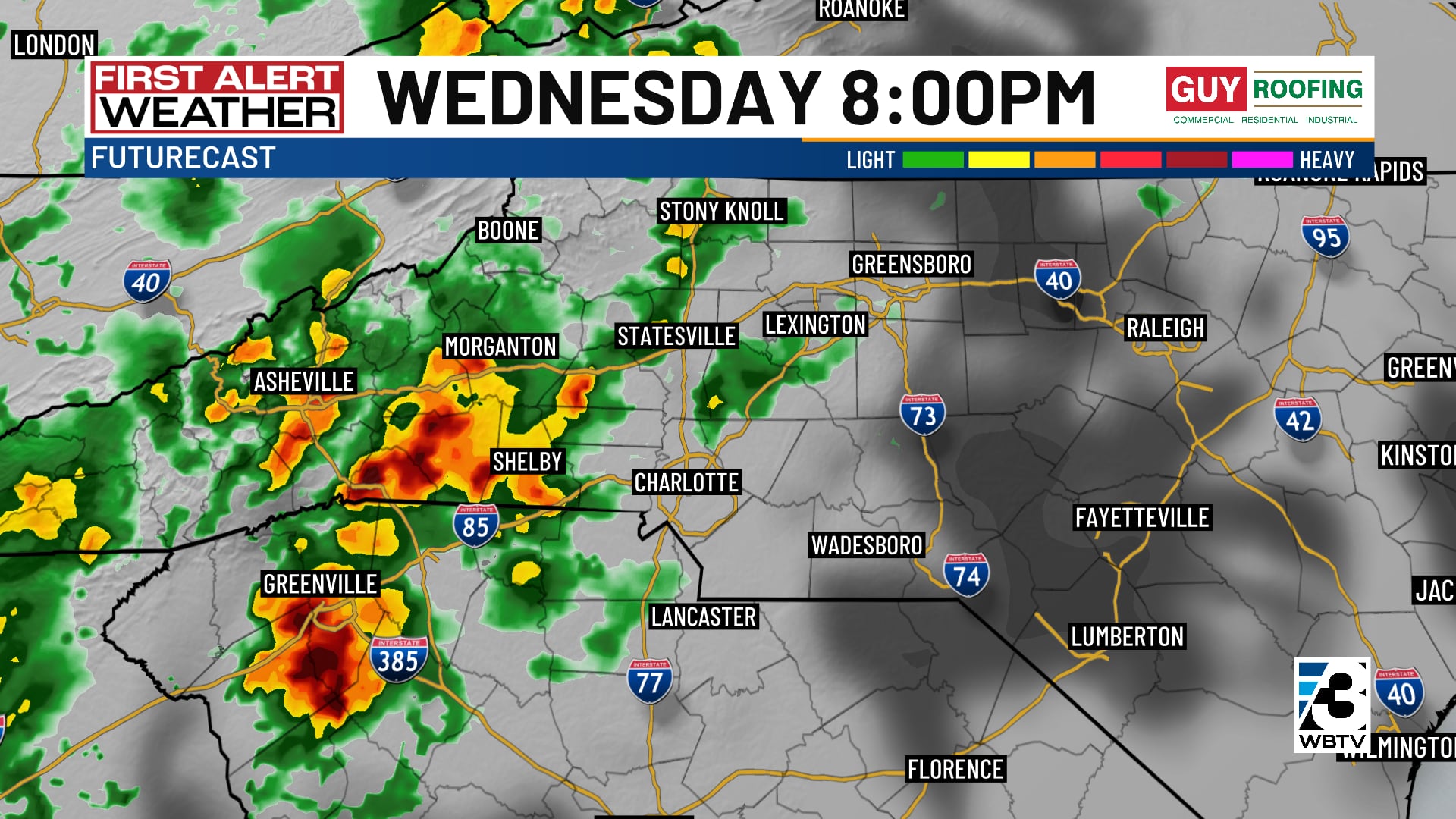
The first wave of light showers moved in around midday Wednesday. Heavier rain will move into the mountains and foothills in the afternoon and evening, spreading into the Piedmont well after sunset. A few rumbles of thunder are possible, although the severe thunderstorm potential remains very low.
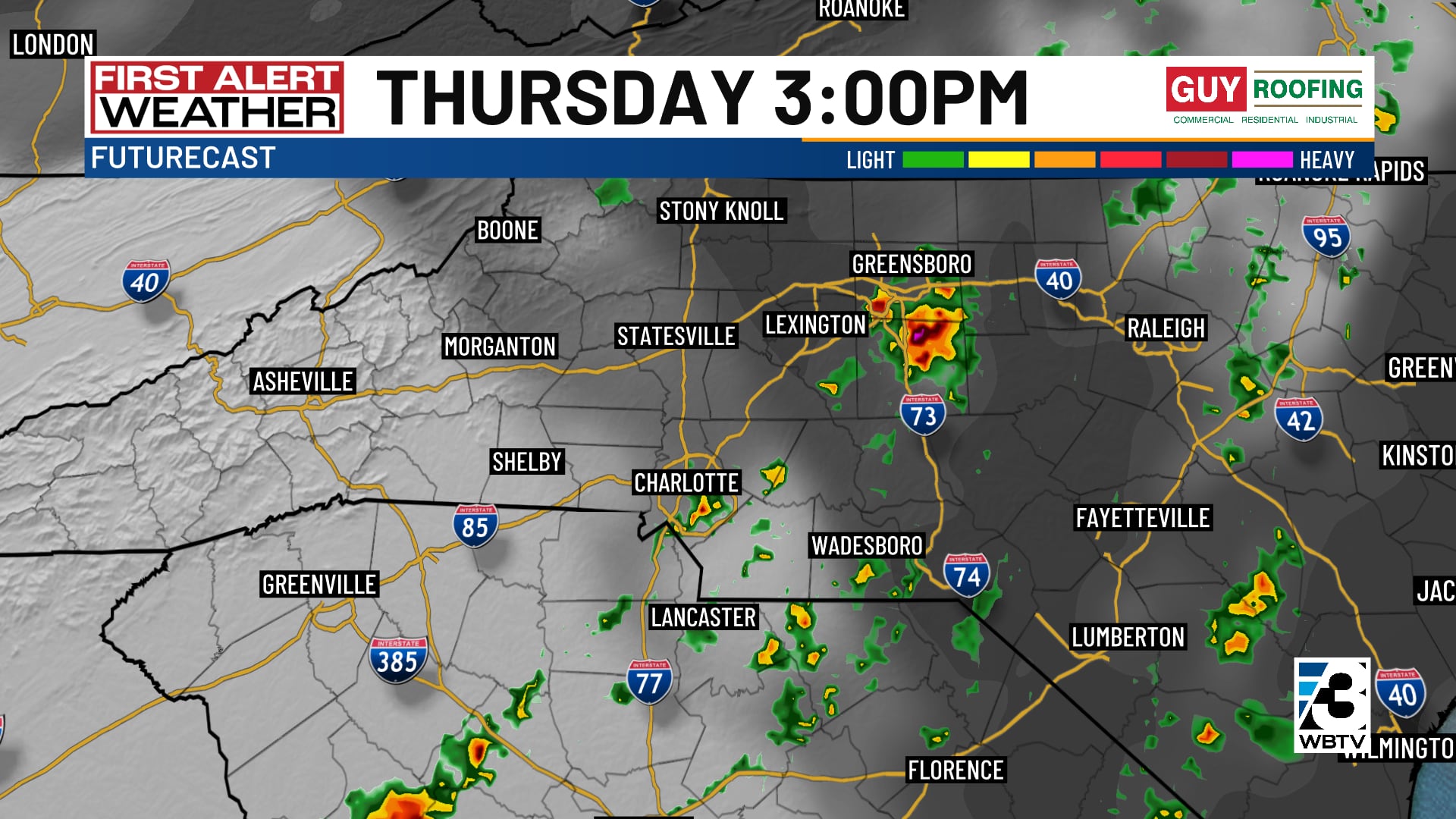
Off-and-on showers will continue Thursday and Thursday night. Thursday will not be a washout, but keep the umbrella and rain jacket handy throughout the day. In between showers, it will be warm and muggy, with highs in the mid 70s.
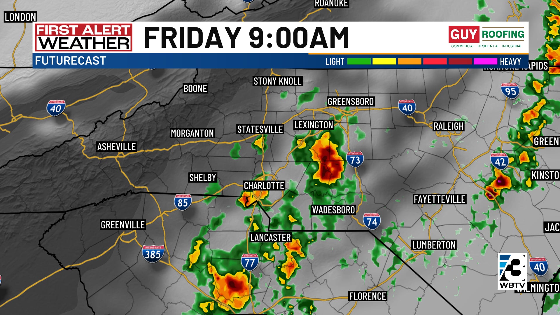
Friday morning will bring the best chance of thunderstorms across the region. While the timing and overall setup does not favor a significant severe weather threat, the First Alert Weather team will keep an eye on the latest trends.
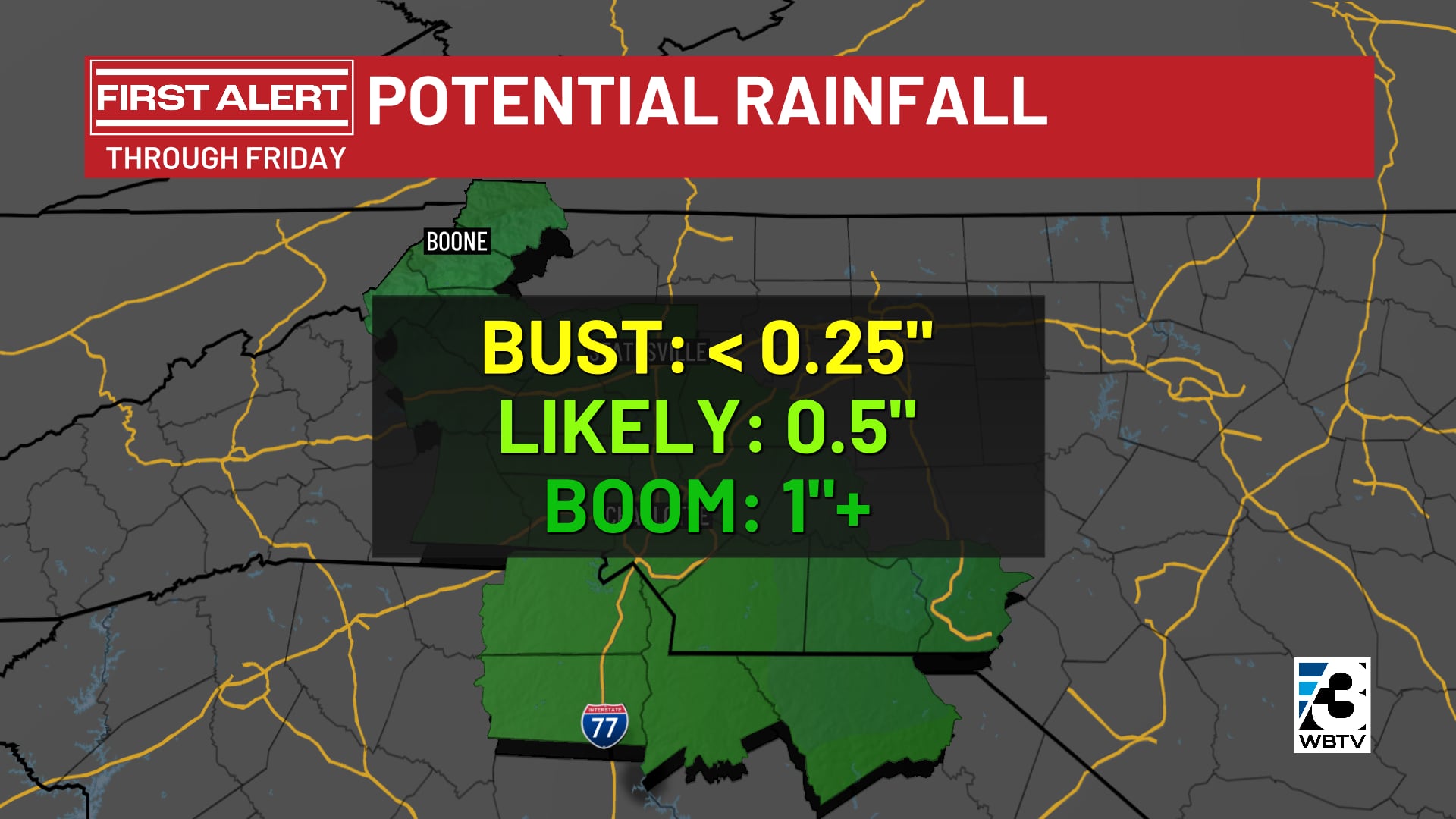
The most-likely range of rainfall totals is around a half-inch in the Piedmont, with close to an inch in the foothills and mountains.
Once the rain moves out, cooler air will settle in for the weekend. Highs Saturday and Sunday will reach the mid to upper 60s, with overnight lows mostly in the 40s.
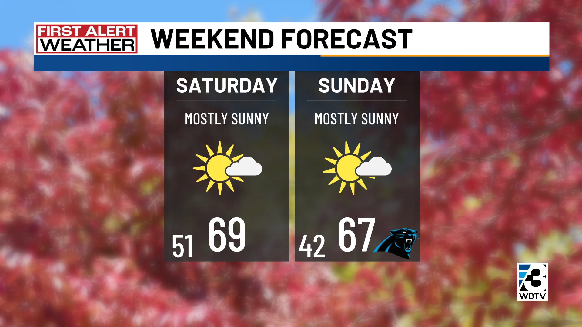
Dry weather will continue into the first half of next week. Temperatures will be slightly above-average, reaching the upper 60s and low 70s.
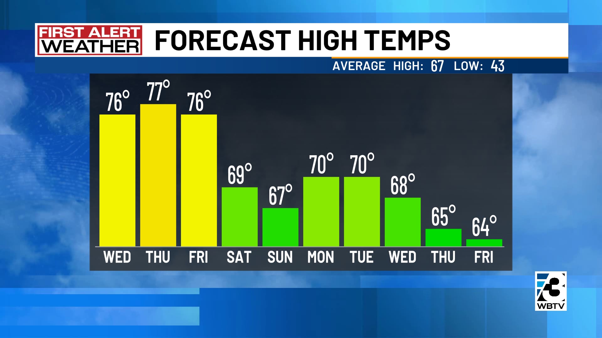
Forecast at a glance
- Wednesday night: Scattered showers and storms
- Thursday: Off-and-on showers
- Friday: Early thunderstorms, then clearing
Download the free WBTV Weather app on your mobile device to get weather alerts and the latest forecast on the go. You can also catch the latest forecast on WBTV’s streaming app -- find it in the app store on your smart TV or streaming device.
Ver nota original ↗
¿Querés un resumen rápido de esta noticia, hecho por nuestra IA?