Rain, storm chances continue in Charlotte region before cooler temps arrive

CHARLOTTE, N.C. (WBTV) - It’s been a soggy evening across the Carolinas, and we’re not quite finished with the rain just yet.
A slow-moving cold front is making its way toward our area, bringing several opportunities for showers and thunderstorms before a much quieter weekend arrives. The good news? We’ve got some lovely fall weather waiting for us on the other side of this system.
Rainy night across the Carolinas
Showers and drizzle will continue through the evening, with a few pockets of heavier rainfall possible overnight.
A line of thunderstorms moving in from the west has been weakening as the atmosphere loses the warmth and energy. That trend should continue overnight, with the line potentially falling apart as it approaches the Charlotte area after midnight.
The greatest concern for heavier rainfall remains in the mountains, where 1 to 2 inches of rain is expected in some area. Elsewhere, rainfall totals will generally range from a quarter of an inch to an inch.
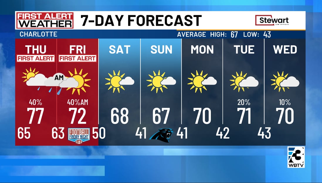
Thursday and Friday: We’re not quite done yet
Keep those umbrellas nearby. Even after tonight’s rain moves through, our slow-moving cold front will keep the atmosphere unsettled.
Thursday brings another opportunity for scattered showers and thunderstorms, especially during the afternoon and evening. It won’t necessarily rain all day, but you may need to dodge a few showers as you head out and about.

By Friday, the front will continue pushing east, bringing another chance for showers and a few thunderstorms, especially around Charlotte and communities farther east.
The mountains should begin drying out sooner, while the Piedmont could see lingering rain chances through Friday morning. And despite the approaching cold front, temperatures will remain warmer than normal for early November.
Weekend is looking much better
After several days of clouds, rain and thunderstorm chances, we’re finally getting a break.
High pressure will build into the Carolinas this weekend, bringing back sunshine and dry weather. We’ll also notice a refreshing change in the air as cooler temperatures settle in behind the front. It won’t be a dramatic blast of cold air, though. Afternoon temperatures should still run a little above normal for this time of year. That sounds like a pretty nice setup for any outdoor plans you’ve been putting off.
Bottom line
Rain continues tonight, with additional showers and thunderstorms possible Thursday and Friday as a slow-moving cold front crosses the Carolinas. By the weekend, we’ll trade the unsettled weather for sunshine, drier air and a more comfortable November feel.
Download the free WBTV Weather app on your mobile device to get weather alerts and the latest forecast on the go. You can also catch the latest forecast on WBTV’s streaming app -- find it in the app store on your smart TV or streaming device.
Ver nota original ↗
¿Querés un resumen rápido de esta noticia, hecho por nuestra IA?