Beautiful fall weekend ahead in the Carolinas, Cold snap next week
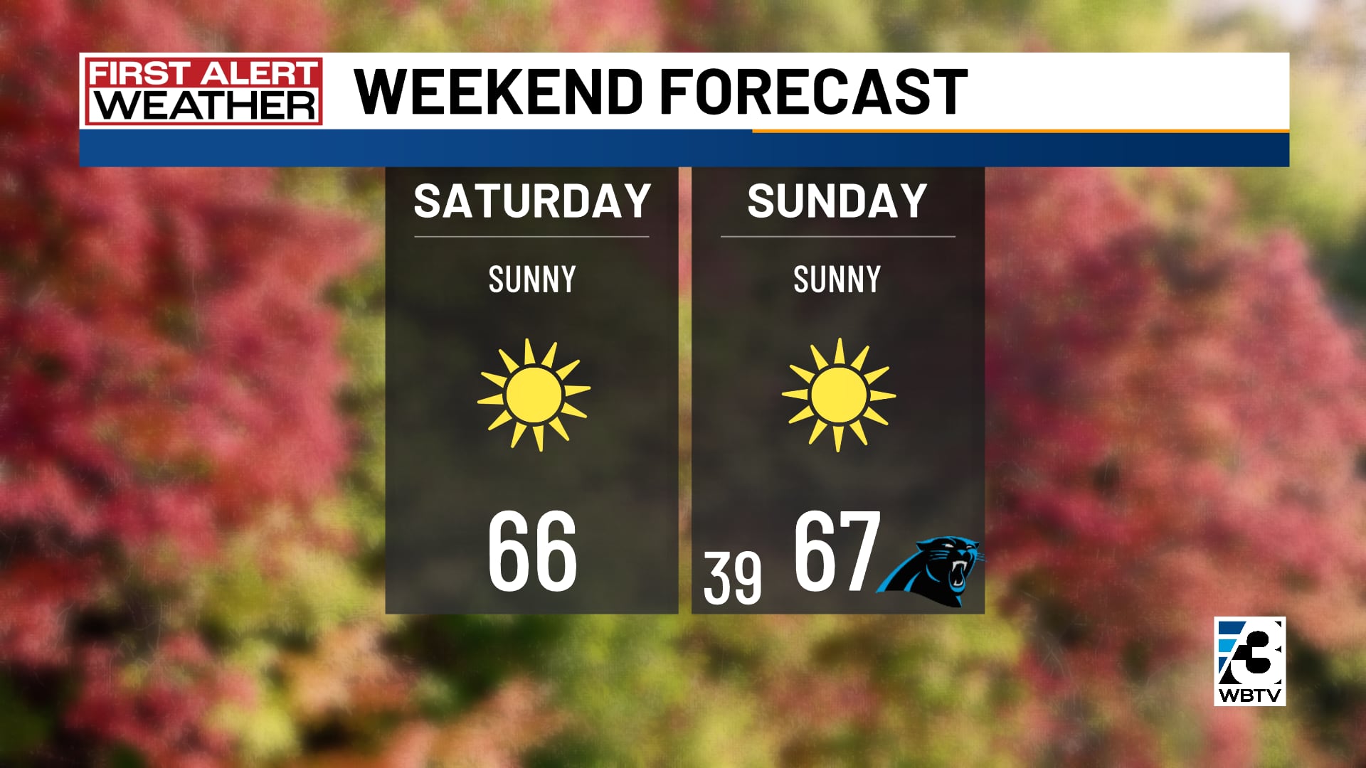
CHARLOTTE, N.C. (WBTV) - Sunshine and cool weather return to the Carolinas this weekend, but some communities will need to watch for patchy frost overnight.
Here is your First Alert for Saturday night and Sunday night: The greatest frost potential near the Interstate 40 corridor. The chance is lower farther south.
Sunshine and chilly nights
Saturday will be sunny in Charlotte, with temperatures rising from around 50 degrees in the morning to mid 60s by midafternoon. Winds will be light at around 10 mph.
Temperatures Saturday night will fall to around 40 degrees in Charlotte and into the 30s in the mountains and parts of the North Carolina Piedmont. Cover sensitive plants where frost is expected.
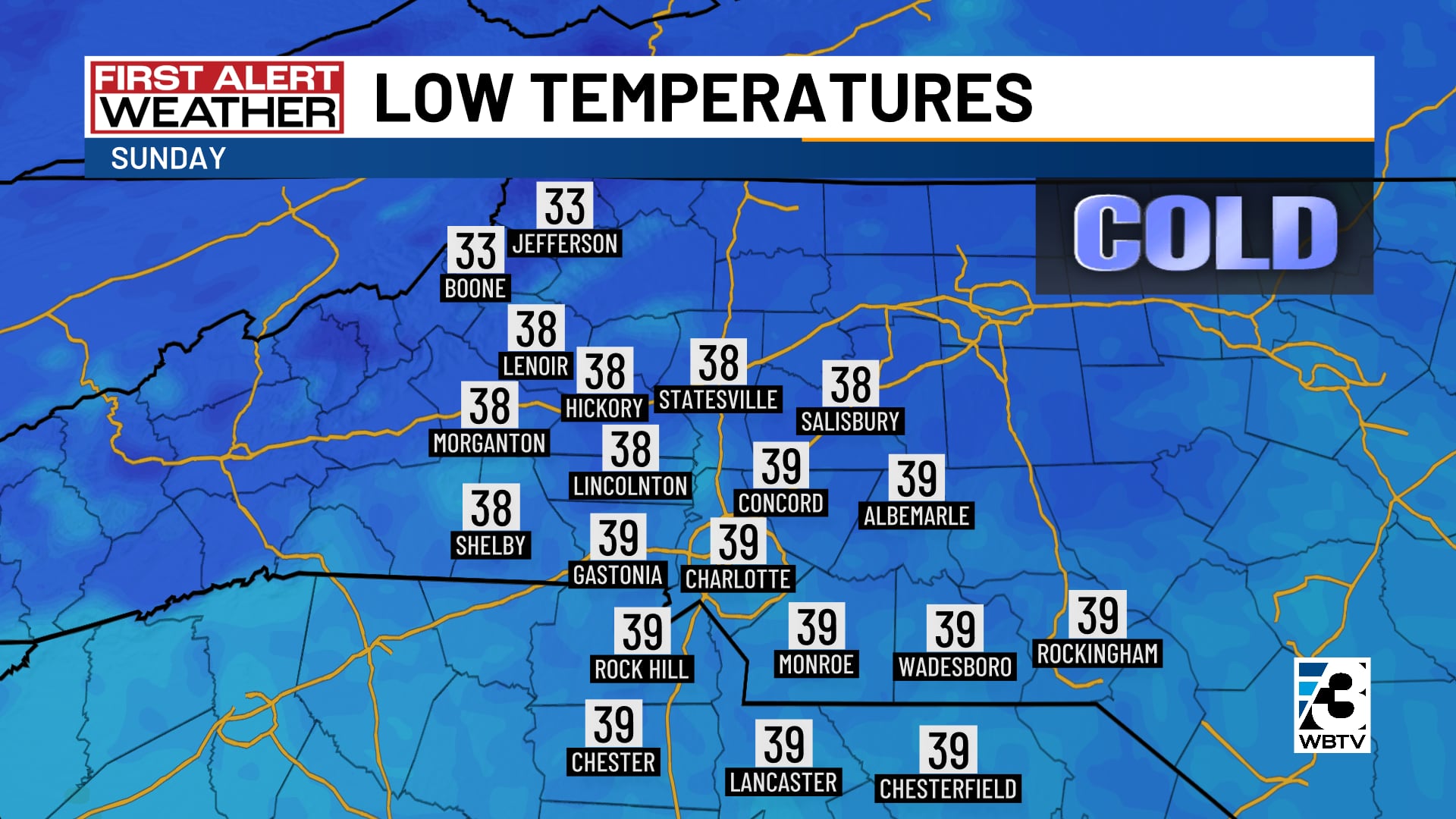
Sunday brings more sunshine and highs around 70 degrees in Charlotte. Another chilly night follows, with patchy frost possible again in cooler areas, especially near I-40.
Warmer midweek, then changes ahead
Dry weather continues through much of next week, with Charlotte afternoon temperatures in the low 70s Monday through Wednesday.
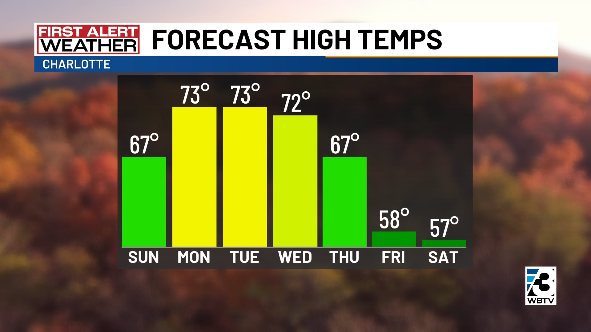
We are alerting you to big changes late next week, when another cooldown looks likely. We are tracking a possible system that could bring a chance of rain, but confidence in the timing and impacts is low. However, it is likely that we will see highs in the 50s and lows near freezing in the Carolinas.
We’ll keep tracking the changes and give you the First Alert as the forecast becomes clearer.
Forecast at a glance
- Weekend: Lots of sun, near-normal temperatures
- Monday through Wednesday: Cool mornings, warm afternoons
- Late next week: Significantly cooler
Download the free WBTV Weather app on your mobile device to get weather alerts and the latest forecast on the go. You can also catch the latest forecast on WBTV’s streaming app -- find it in the app store on your smart TV or streaming device.
Ver nota original ↗
¿Querés un resumen rápido de esta noticia, hecho por nuestra IA?