Autumn warm spell to end with first frost in Charlotte: Latest forecast
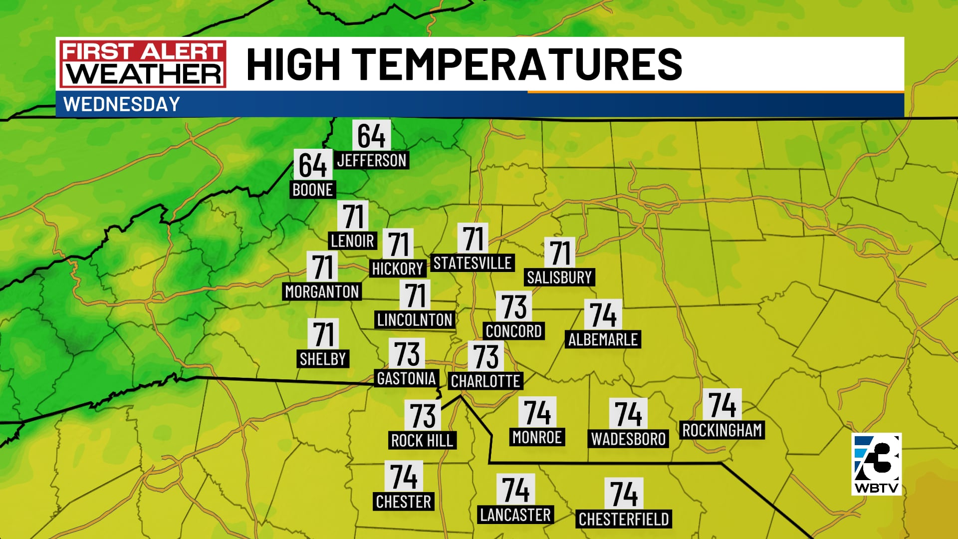
CHARLOTTE, N.C. (WBTV) - After another cool start, Tuesday’s high temperatures warmed well into the 70s, almost ten degrees above average.
The warmth will continue one more day before the coldest air so far this season drops in for the weekend.
Unseasonably warm Wednesday
Clear skies overnight will drop temperatures to the 40s by early Wednesday morning.
Despite a few more clouds overhead, highs will reach the low to mid 70s by Wednesday afternoon.
Showers less likely Thursday
On Thursday, a strong cold front will sweep across the Carolinas.
With little moisture available, the chance of measurable rain has dropped to 20% to 30%.
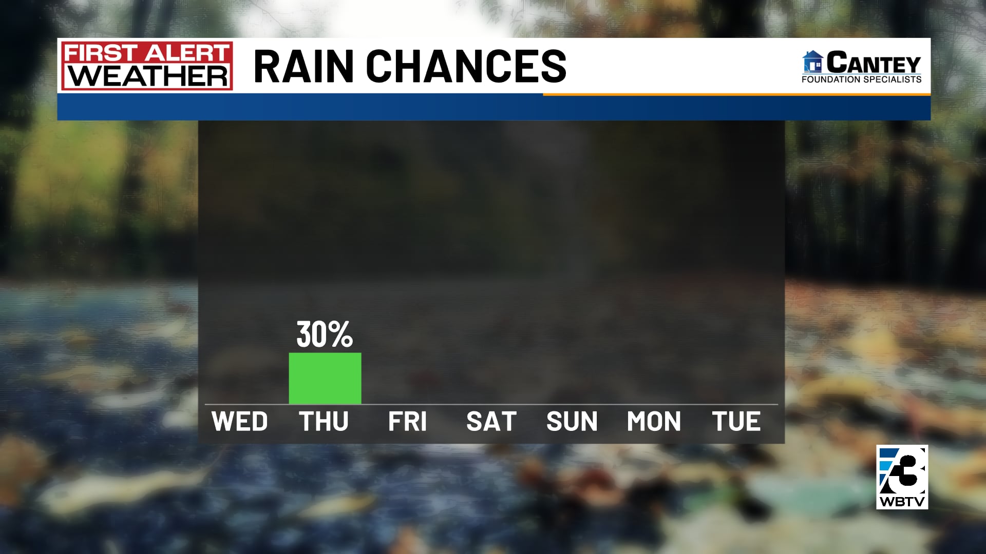
The best chance of showers will be in the mountains, and even there, rainfall totals will likely be less than a quarter-inch.
Chilly weather coming
Significantly colder air will charge in behind the cold front.
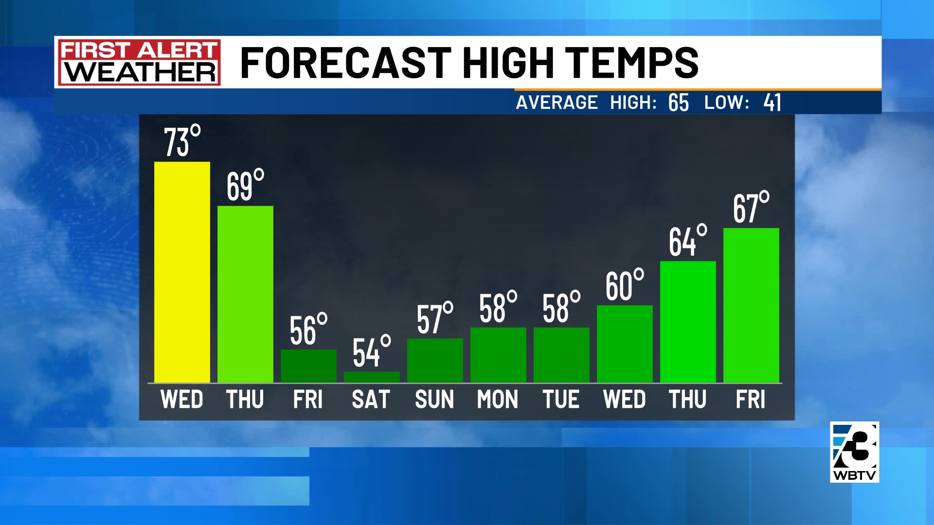
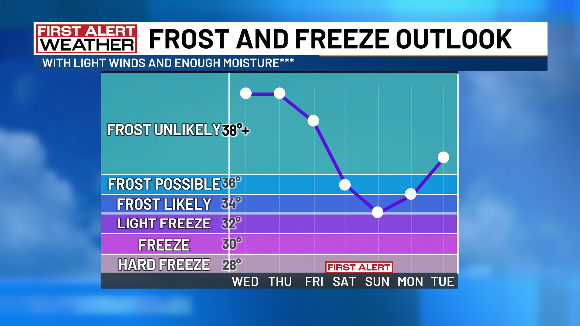
Highs in Charlotte Friday through Monday will only reach the 50s, and the first frost of the season looks likely Saturday and Sunday mornings.
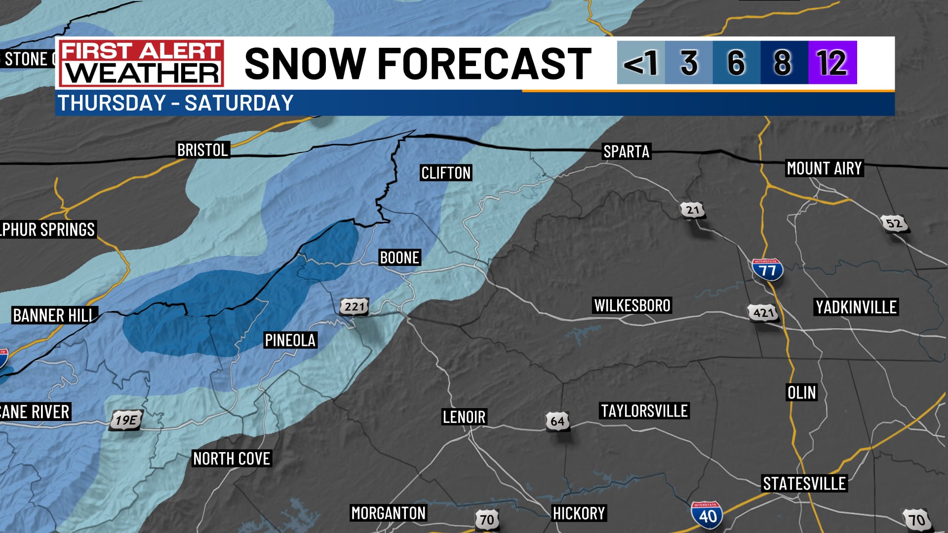
The cold air will combine with lingering moisture to produce snow showers in the mountains late Thursday night and Friday.
Accumulations will be modest: most likely less than an inch on lawns and rooftops in Ashe, Watauga and Avery counties.
Some of the highest peaks along the TennesseeNorth Carolina state line could add up a few inches of snow for the first time this season.
Forecast at a glance
- Wednesday: Cool morning, warm afternoon
- Thursday: Light rain showers, breezy
- Friday through Sunday: Cold, mountain snow showers
Download the free WBTV Weather app on your mobile device to get weather alerts and the latest forecast on the go. You can also catch the latest forecast on WBTV’s streaming app -- find it in the app store on your smart TV or streaming device.
Ver nota original ↗
¿Querés un resumen rápido de esta noticia, hecho por nuestra IA?