Run of comfortable weather to end ahead of freezing temperatures in Charlotte
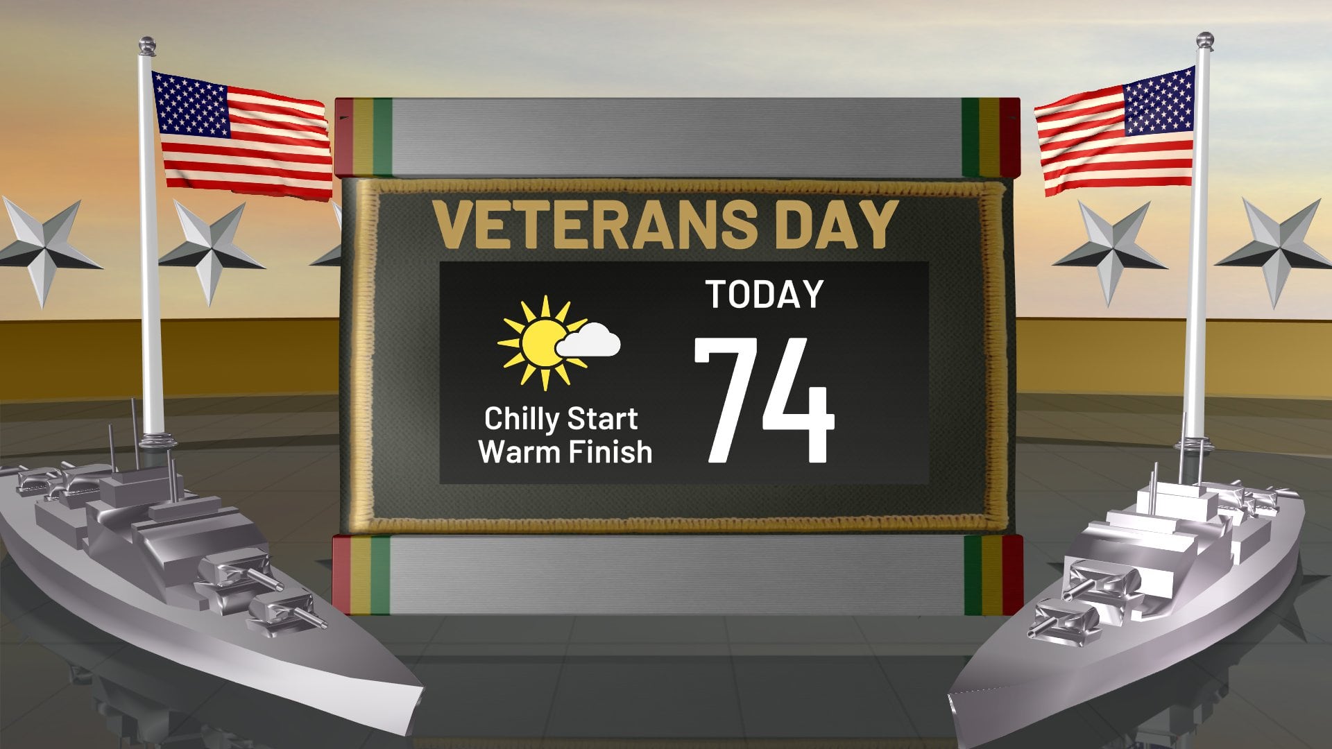
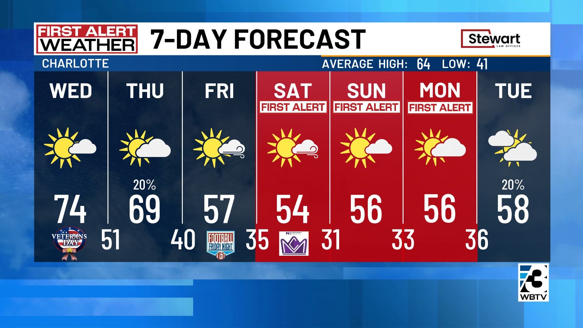
CHARLOTTE, N.C. (WBTV) - There will be plenty of sunshine to go around again Wednesday in Charlotte with a pleasant afternoon high temperature back in the low to mid-70s.
Patchy clouds and chilly conditions are expected again overnight with lows in upper 40s to lower 50s.
Cooldown coming
On Thursday, a strong cold front will cross the Carolinas.
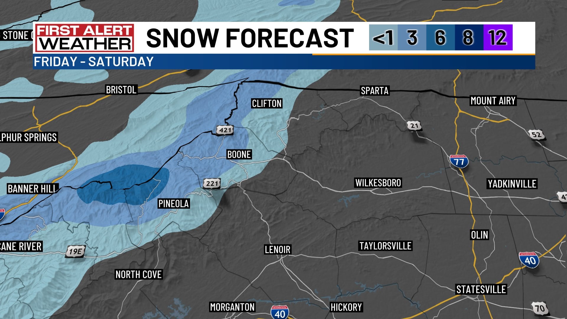
With little moisture to work with, there may only be a couple of spotty showers with the frontal passage (best chance in the mountains) before the coldest air of the season arrives for Friday and the weekend.
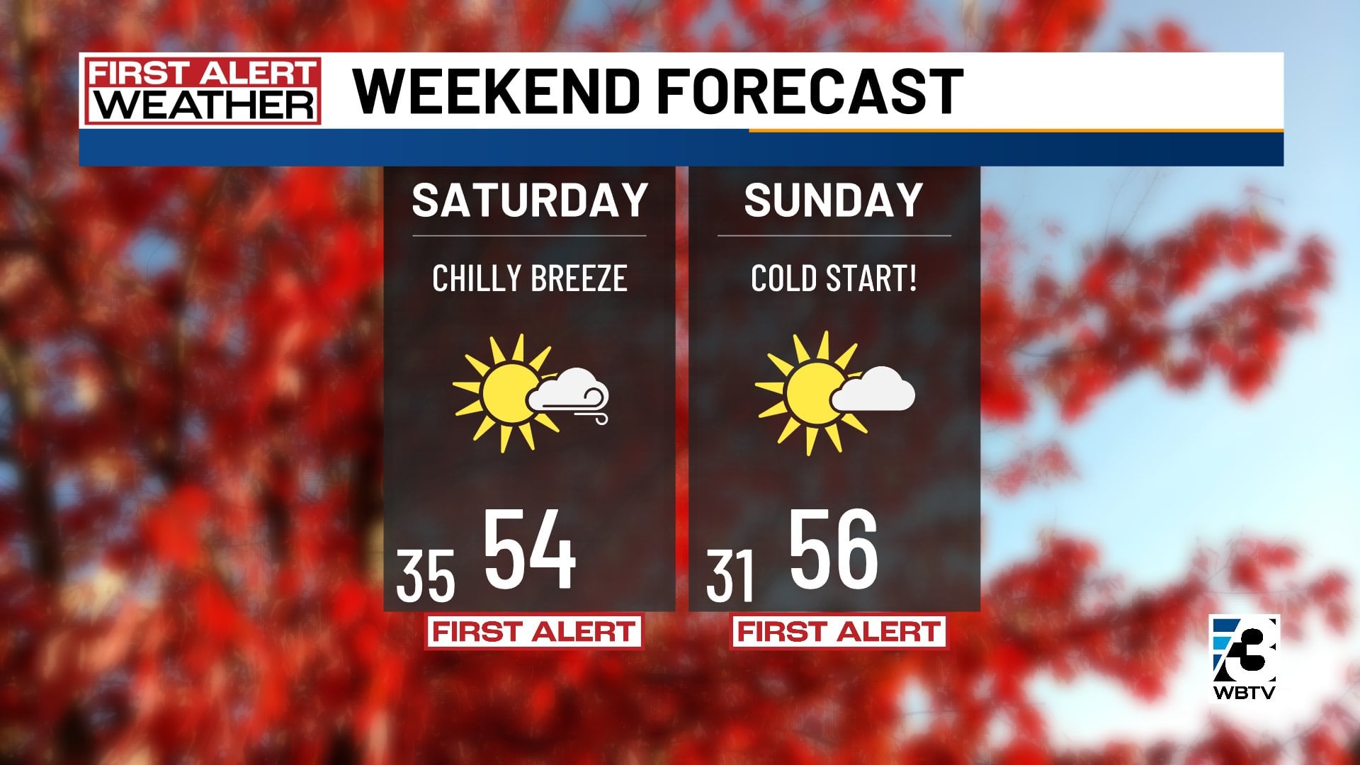
Highs Thursday will fall back to the seasonal mid-60s before dipping further into the 50s for Friday and the weekend.
Frost likely this weekend
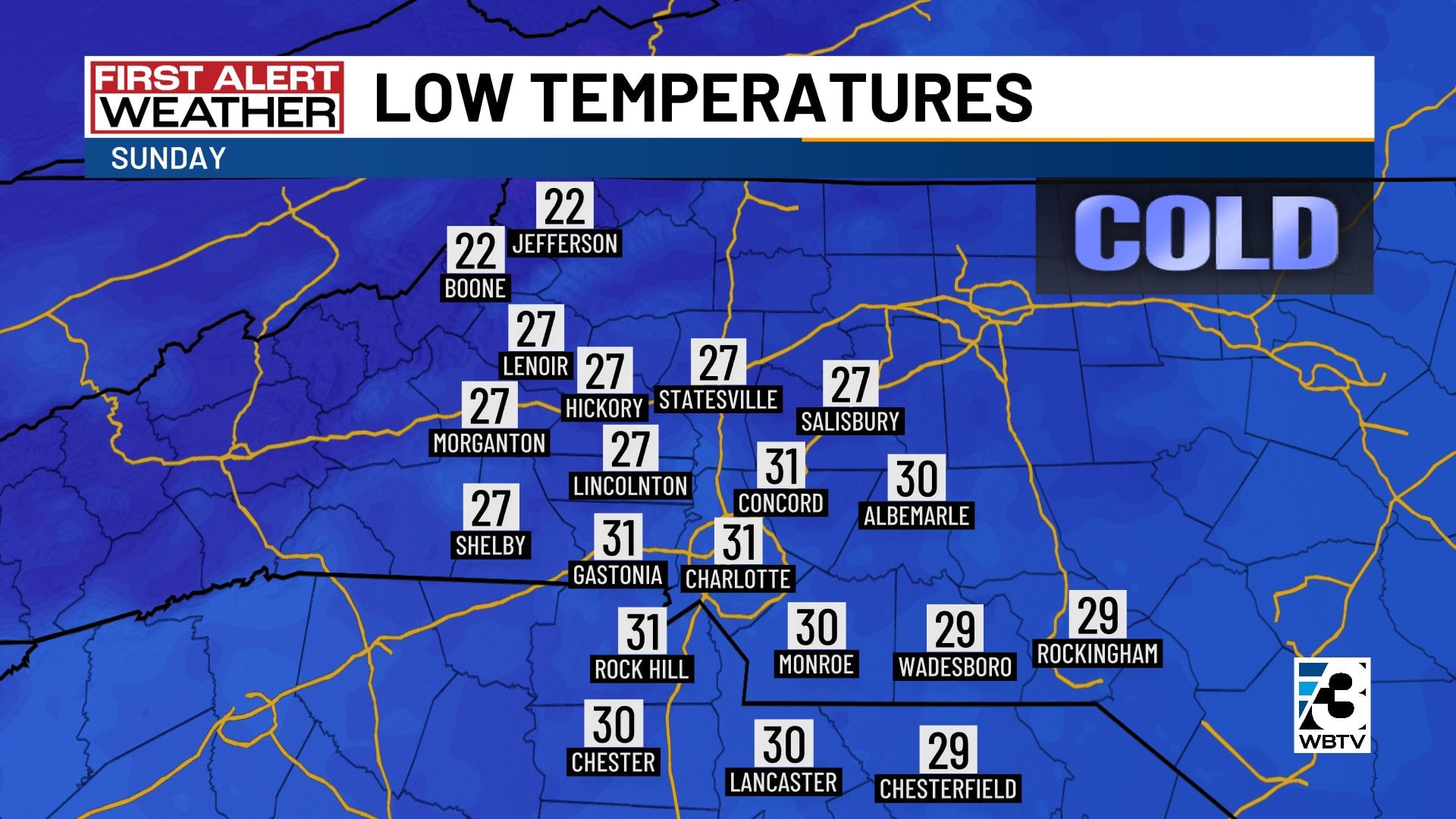
Overnight lows in the 20s and 30s are forecast for this weekend. There will likely be patchy frost around the Charlotte area (first time this autumn season) Sunday morning with below-freezing low temperatures areawide.
Temperatures will still be close to freezing in Charlotte Monday morning as we go back to work and school. Highs will hold in the chilly 50s Monday afternoon.
We will return to the seasonal 60s by the middle of next week, but we are unlikely to get back into the warm 70s again anytime soon.
Forecast at a glance
- Wednesday: Lots of sunshine, chilly start, last day in the 70s
- Thursday: Best shower chance in the mts, highs in 60s
- Friday, weekend: Coldest air of the season, gusty breezes
Download the free WBTV Weather app on your mobile device to get weather alerts and the latest forecast on the go. You can also catch the latest forecast on WBTV’s streaming app -- find it in the app store on your smart TV or streaming device.
Ver nota original ↗
¿Querés un resumen rápido de esta noticia, hecho por nuestra IA?