Gale warning, wind, high surf advisories in effect for parts of Hawaii
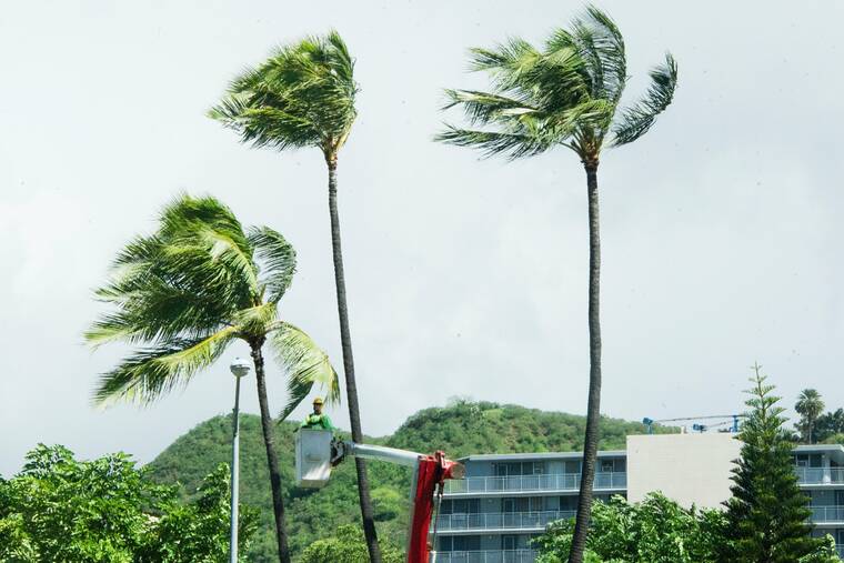
Windy conditions and large surf are expected across the islands today, with a gale warning, wind advisory and high surf advisory in effect for parts of the state.
A gale warning is in effect until 6 a.m. Thursday for Maalaea Bay, Pailolo Channel, Alenuihaha Channel and waters off the Big Island’s leeward and southeast coasts, according to the National Weather Service. Forecasters said northeast winds of up to about 40 mph and seas of up to 14 feet could capsize or damage vessels.
A wind advisory is also in effect until 6 a.m. Thursday for parts of Maui County and the Big Island, with northeast winds of 20 to 30 mph and gusts of up to 50 mph. Forecasters said the winds will be strongest through gaps in the mountains and over and downslope of ridges through this evening. They said strong, gusty winds are also possible on Oahu and Kauai, which are not under the advisory.
Weather officials said advisory-level winds can knock down tree branches, tear off shingles, blow away tents and awnings and make it hard to steer, especially for drivers of high-profile vehicles. Residents and visitors in Maui County and on the Big Island should be prepared for power outages.
A high surf advisory is in effect until 6 p.m. Thursday for the north and west shores of Kauai County, Oahu and Molokai and the north shores of Maui. Surf on north shores is forecast to rise to 15 to 20 feet today and peak at 18 to 24 feet tonight, possibly into Thursday morning, while west shores are forecast to see 10 to 15 feet today and 14 to 18 feet tonight, forecasters said. Strong breaking waves and currents make swimming dangerous.
Near-warning-level surf may linger into Thursday before falling below advisory levels Thursday night, weather officials said. Beachgoers are urged to heed the advice of ocean safety officials.
Don't miss out on what's happening!
Stay in touch with breaking news, as it happens, conveniently in your email inbox. It's FREE!
By clicking to sign up, you agree to Star-Advertiser's and Google's Terms of Service and Privacy Policy. This form is protected by reCAPTCHA.
A small craft advisory remains in effect until 6 a.m. Thursday for most other coastal waters, with northeast winds of up to about 29 mph and seas of up to 14 feet. The NWS said it may need to be extended.
Fire weather conditions will stay near critical levels through Thursday, forecasters said, with winds and humidity likely reaching critical levels today. They said red flag warnings are not expected at this time because dry vegetation conditions remain below critical levels after above-average rainfall in recent months.
Conditions should be relatively dry today, with showers for windward and mauka areas tonight into Thursday as a band of moisture moves south across the state. Forecasters said the tradewinds should begin to ease Friday afternoon but strengthen Saturday night into Sunday.
Tropical Storm Pena was about 1,020 miles southwest of Honolulu at 5 a.m. today with maximum sustained winds of about 45 mph and was moving west-southwest at about 9 mph, according to the Central Pacific Hurricane Center in Honolulu. Forecasters said little change in strength is expected over the next day or so, followed by gradual weakening after Thursday.
Ver nota original ↗
¿Querés un resumen rápido de esta noticia, hecho por nuestra IA?