Chilly weekend ahead for Charlotte, with mountain snow and frost possible
CHARLOTTE, N.C. (WBTV) - Chilly breezes will continue Friday, with sunshine giving way to mostly cloudy skies.
A spotty afternoon shower is possible in the Piedmont, and highs will reach the mid-to-upper 50s.
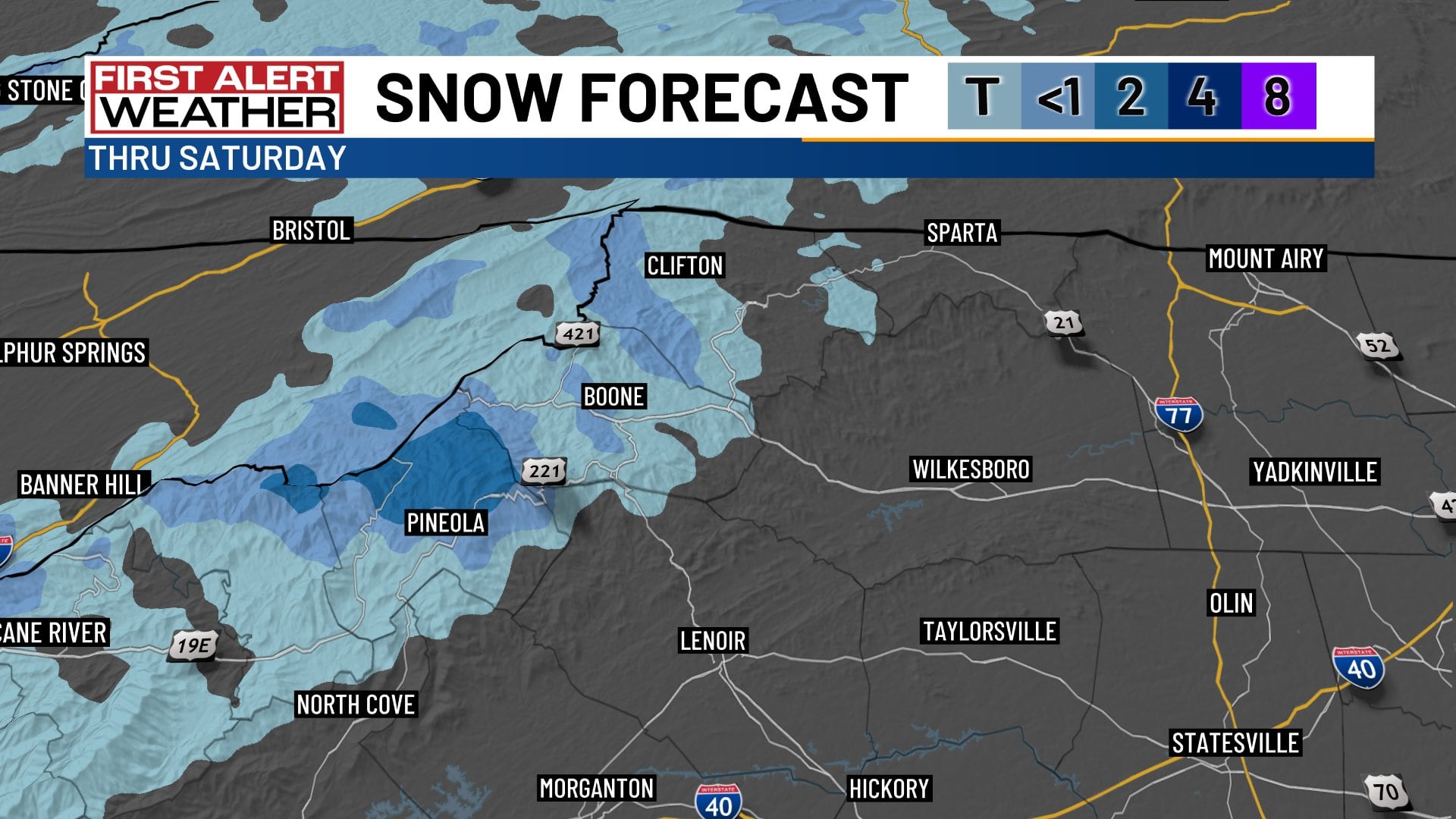
In the mountains, a small, slushy accumulation is possible around Boone, mainly on non-road surfaces. Higher elevations along the North Carolina-Tennessee line could see several more inches of wet snow before precipitation tapers off Saturday morning.
Mostly sunny weekend
Mostly sunny skies are expected both weekend days, with highs in the 50s. A chilly breeze Saturday will settle down overnight, and lows will drop into the 20s and 30s over the weekend.
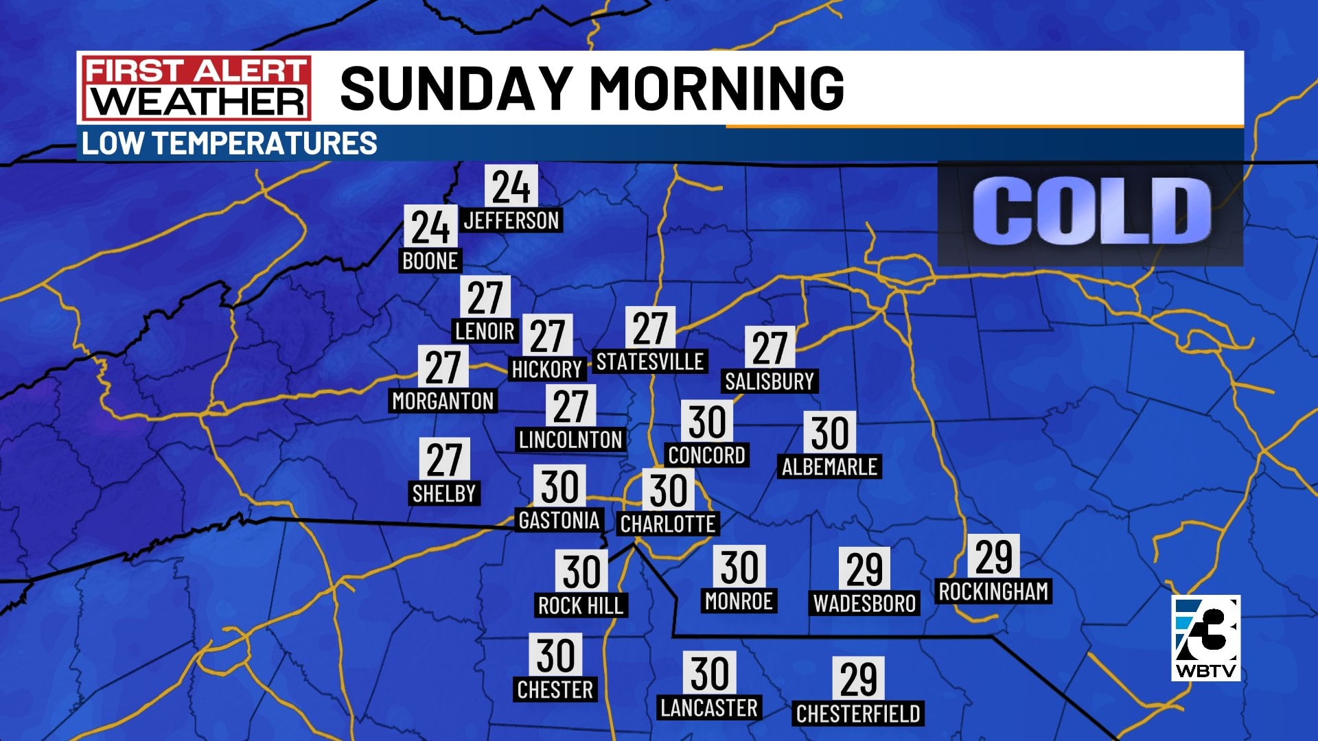
Patchy frost is likely around Charlotte on Sunday morning, potentially marking the first frost of the autumn season. Below-freezing temperatures are forecast across the area.
Close to freezing Monday morning
Charlotte will remain close to freezing Monday morning, with highs in the 50s Monday afternoon.
Temperatures are expected to return to the seasonable 60s by the middle of next week, but a return to the 70s is unlikely anytime soon.
Forecast at a glance
- Friday: AM sun, PM clouds, gusty breezes all day, 50s
- Weekend: Sunshine, chilly 50s by day, 20s & 30s at night
- Next week: Lots of sunshine, no rain, milder 60s by midweek
Download the free WBTV Weather app on your mobile device to get weather alerts and the latest forecast on the go. You can also catch the latest forecast on WBTV’s streaming app -- find it in the app store on your smart TV or streaming device.
Ver nota original ↗
¿Querés un resumen rápido de esta noticia, hecho por nuestra IA?