
A chilly weekend ahead before a rainy start to the next week
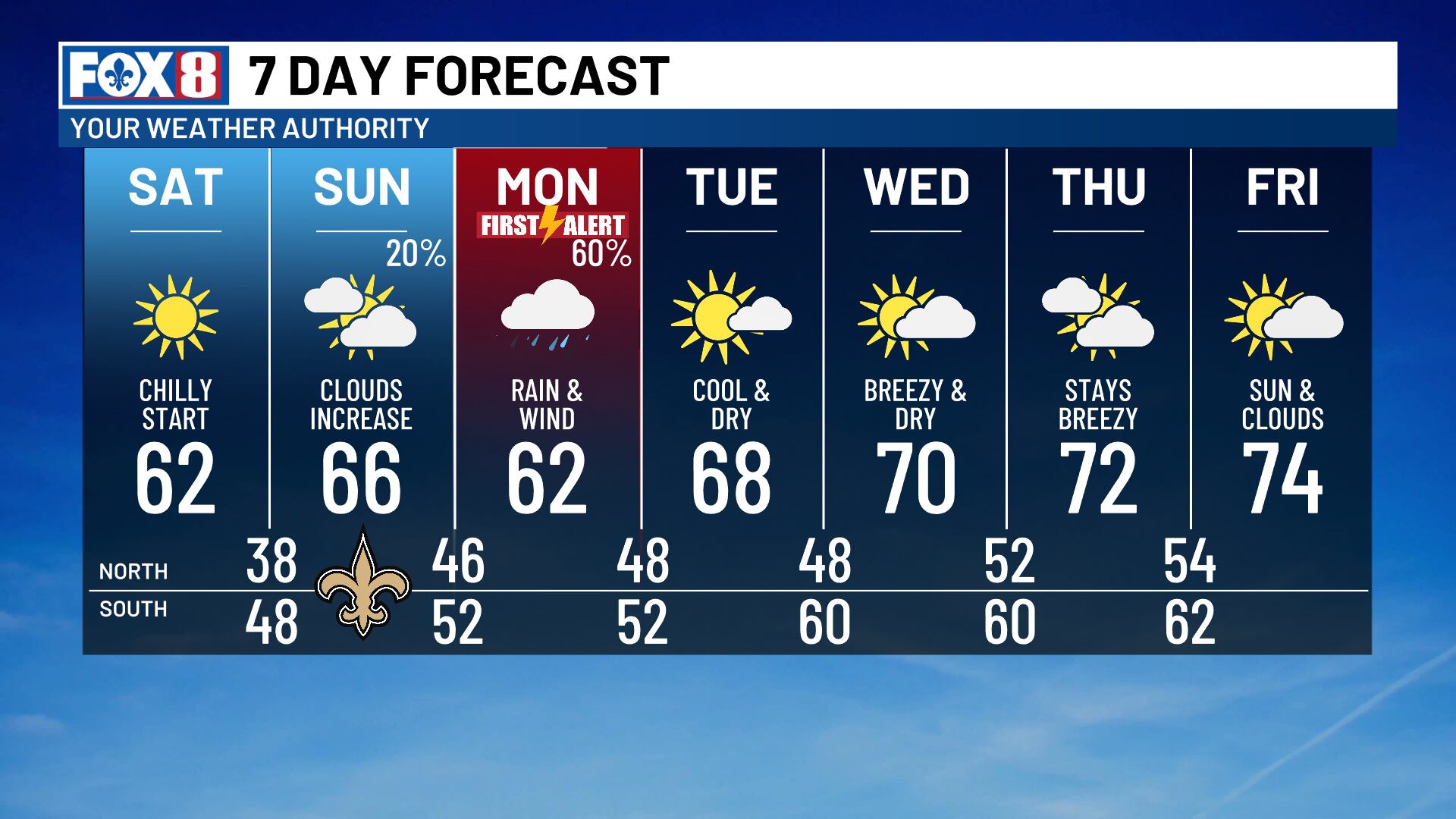
NEW ORLEANS (WVUE) - A cold front has set the stage for a chilly weekend ahead. But a Gulf low is expected to bring a big change in the weather for the start of the new work week.
Saturday morning brings the possibility of patchy frost on the north shore as lows fall to the upper 30s. The south shore stays cool and mainly in the 40s. All of our daytime highs will warm to around 60, with some areas possibly staying in the upper 50s.
Sunday starts chilly as well, but a shifting pattern is underway. Clouds will build as a disturbance approaches from the west. Scattered rain will arrive Sunday night and linger through much of Monday.
The upper-level disturbance will help spur a Gulf Low that will move just south of our coastline throughout Monday. This system will bring scattered light to moderate rain to much of the day. Many areas will see less than an inch of accumulation, though a swath of around two inches is also possible. Several models carry that higher amount through the New Orleans metro, where we’re monitoring for some isolated street flooding potential.
Persistent easterly and northeast winds of 30+ mph may bring some coastal flood concerns for Monday and Tuesday. The winds will remain elevated all week.
The rain will exit late Monday, and we’ll dry out for the remainder of next week. Highs will start the week in the lower 60s and rise back to the mid-70s by Friday.
See a spelling or grammar error in our story? Click Here to report it. Please include the headline.
Subscribe to the Fox 8 YouTube channel.
Ver nota original ↗
¿Querés un resumen rápido de esta noticia, hecho por nuestra IA?


