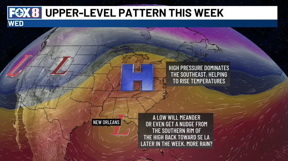
Cold light rain moves out with a warming trend mid-week

NEW ORLEANS (WVUE) - Light rain is moving out giving way to a chilly Monday night. Lows by Tuesday morning in the mid 40s north and mid 50s south.
Clouds start to break up this evening, and skies should clear out around sunset as a disturbance slides off toward Florida.
Tuesday morning starts with a clearing sky and a chilly feel as high pressure builds back in.
Highs warm into the lower and mid 70s by Wednesday and Thursday.
Cloudy and chilly for now as the light rain chance moves out this evening. Tuesday will feature sun returning with a cool start 46° north and 56° south. Highs Tuesday at 66°. A warm-up is on the way later in the week into the weekend. pic.twitter.com/6aoeCD6QTy
— Bruce Katz (@BruceKatzFOX8) November 16, 2026
The Gulf low that brought the light rain continues gusty off shore winds. A Gale Warning is in place for the outer coastal waters until 6 AM Tuesday, and a Small Craft Advisory covers the rest of the marine zones with winds of 20 to 30 knots and seas of 5 to 8 feet.
Hazardous marine conditions are expected to come and go through much of the week.
For the weekend, east to northeast winds stay locked in and moisture stays limited, with no organized rain threat.
Highs and lows run above normal, with a few areas flirting near 80° west of Interstate 55.
See a spelling or grammar error in our story? Click Here to report it. Please include the headline.
Subscribe to the Fox 8 YouTube channel.
Ver nota original ↗
¿Querés un resumen rápido de esta noticia, hecho por nuestra IA?