Chance for weekend rain ahead of Thanksgiving week cooldown: Charlotte forecast
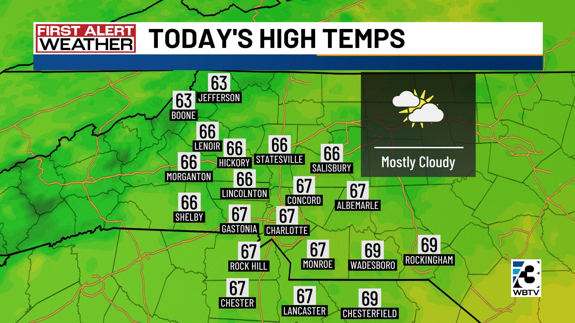
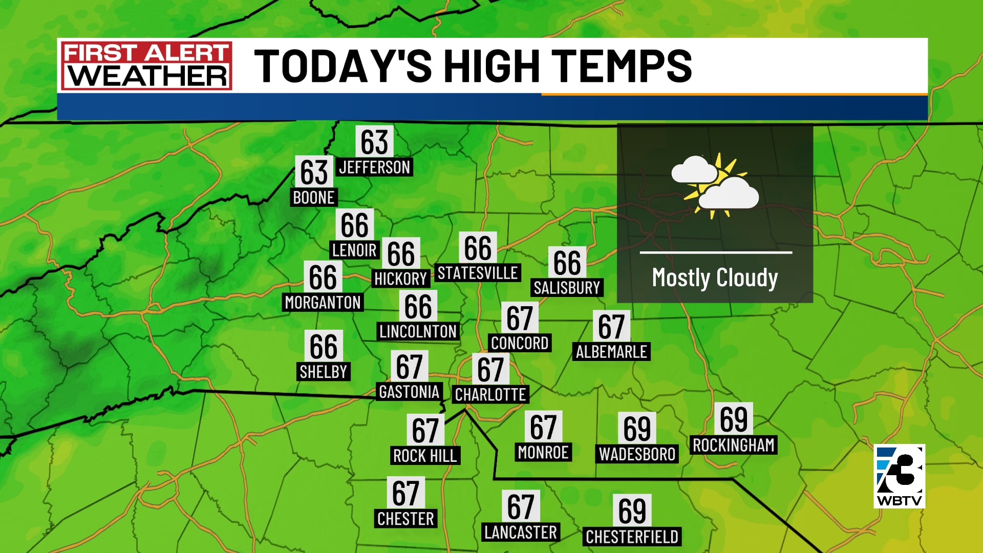
CHARLOTTE, N.C. (WBTV) - Mostly cloudy skies are in the forecast Thursday across the Carolinas.
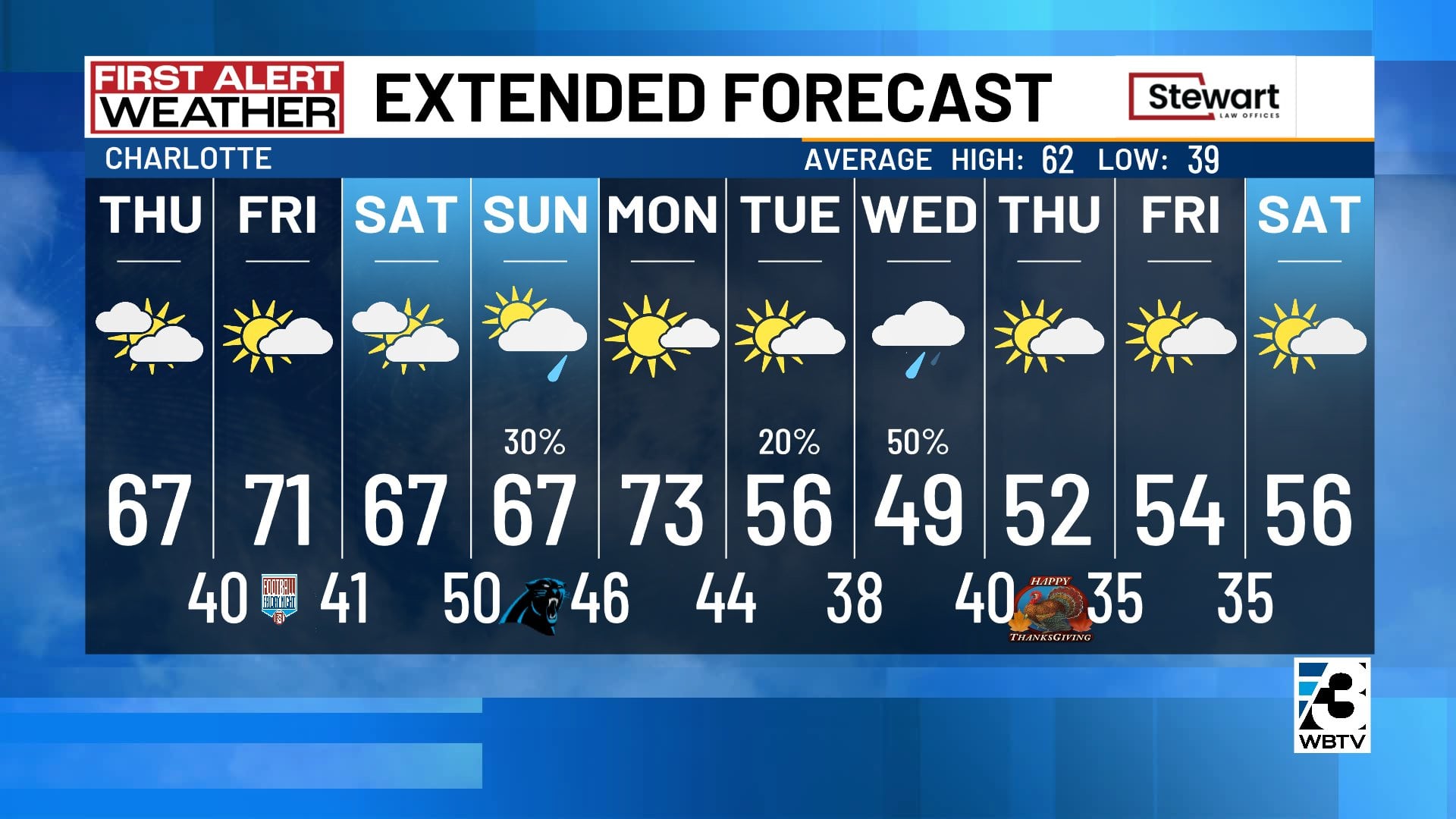
After another chilly start, high temperatures will top out in the middle 60s again -- it just won’t be as pretty as recent days. Dry and chilly conditions are in store overnight with lows in the 30s and 40s.
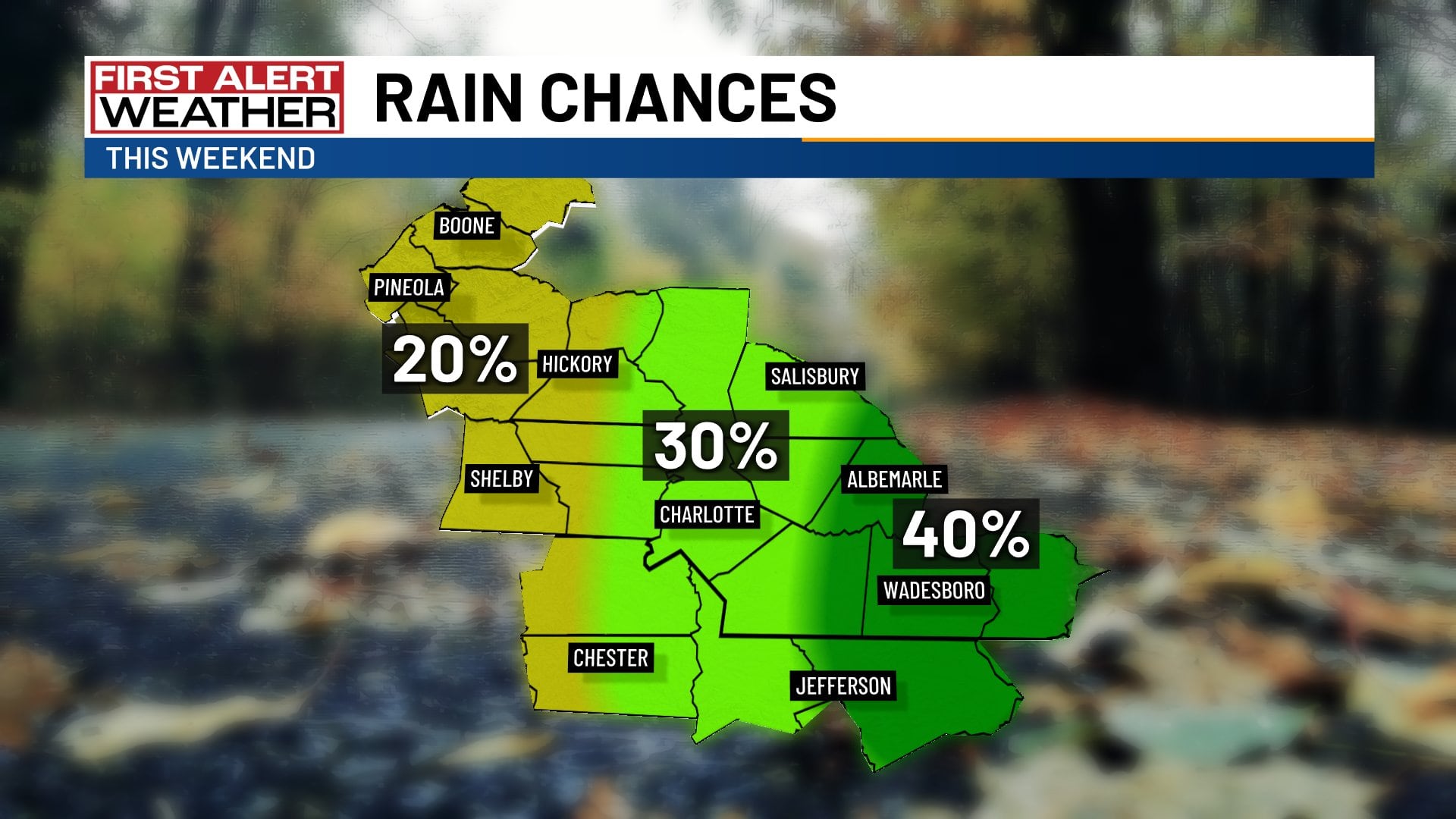
Chance for weekend rain
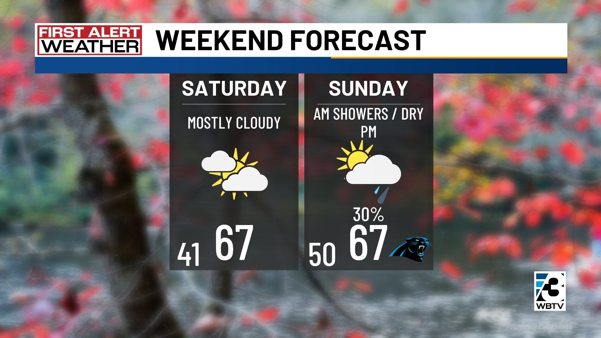
Intervals of clouds and sun are in the forecast Friday with warm highs close to 70 degrees. Saturday looks mostly cloudy, mild and dry. Highs will top out in the middle 60s.
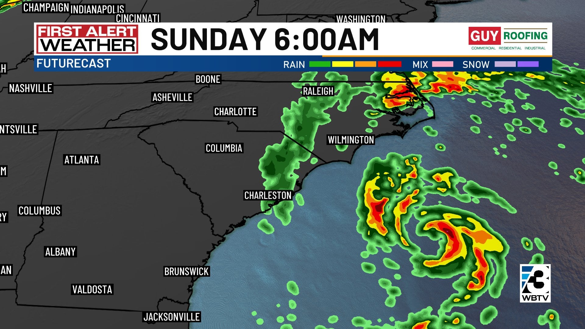
A coastal low will throw some showers back our way Saturday night into early Sunday, as a developing storm system rolls north just off the North Carolina coast Sunday.
Any rain looks to be gone by Sunday afternoon with clouds and sun and highs holding in the middle 60s.
Cooldown coming next week
Monday will be warm with highs in the lower 70s. A cold front will blow through on Tuesday, knocking high temperatures back down into the chilly 40s and 50s.
While Thanksgiving looks dry under partly cloudy skies, Wednesday could bring rain, perhaps hampering your holiday travel plans.
Forecast at a glance
- Thursday: Mostly cloudy, cold start, mild finish in the mid-60s
- Friday: Sun and clouds, warm afternoon temps near 70 degrees
- Saturday: Mostly cloudy but dry all day, middle 60s
- Sunday: Mostly cloudy, AM showers, dry PM, mid-60s
Download the free WBTV Weather app on your mobile device to get weather alerts and the latest forecast on the go. You can also catch the latest forecast on WBTV’s streaming app -- find it in the app store on your smart TV or streaming device.
Ver nota original ↗
¿Querés un resumen rápido de esta noticia, hecho por nuestra IA?