Charlotte stays mild and dry before weekend shower chances
CHARLOTTE, N.C. (WBTV) - The rest of the workweek looks dry, but as we head into the weekend, a coastal low could bring some showers and gusty winds to portions of the Charlotte metro area.
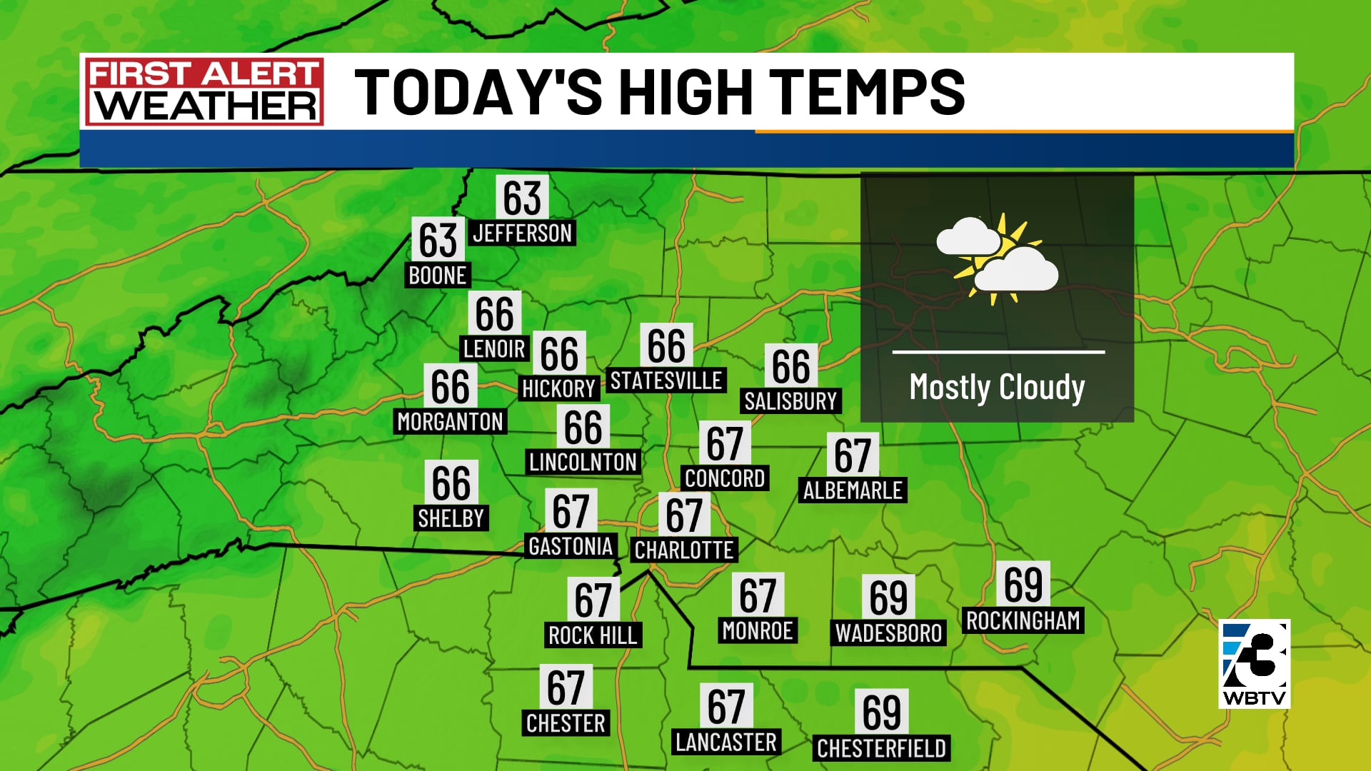
After another chilly morning, we wrap up Thursday afternoon with partly sunny skies and highs in the upper 60s. By night, it will be partly cloudy and cool, with lows in the 30s and 40s.
Friday is still on track to be quiet and dry with mostly sunny to partly cloudy skies; expect highs in the upper 60s and lower 70s.
Weekend shower chances
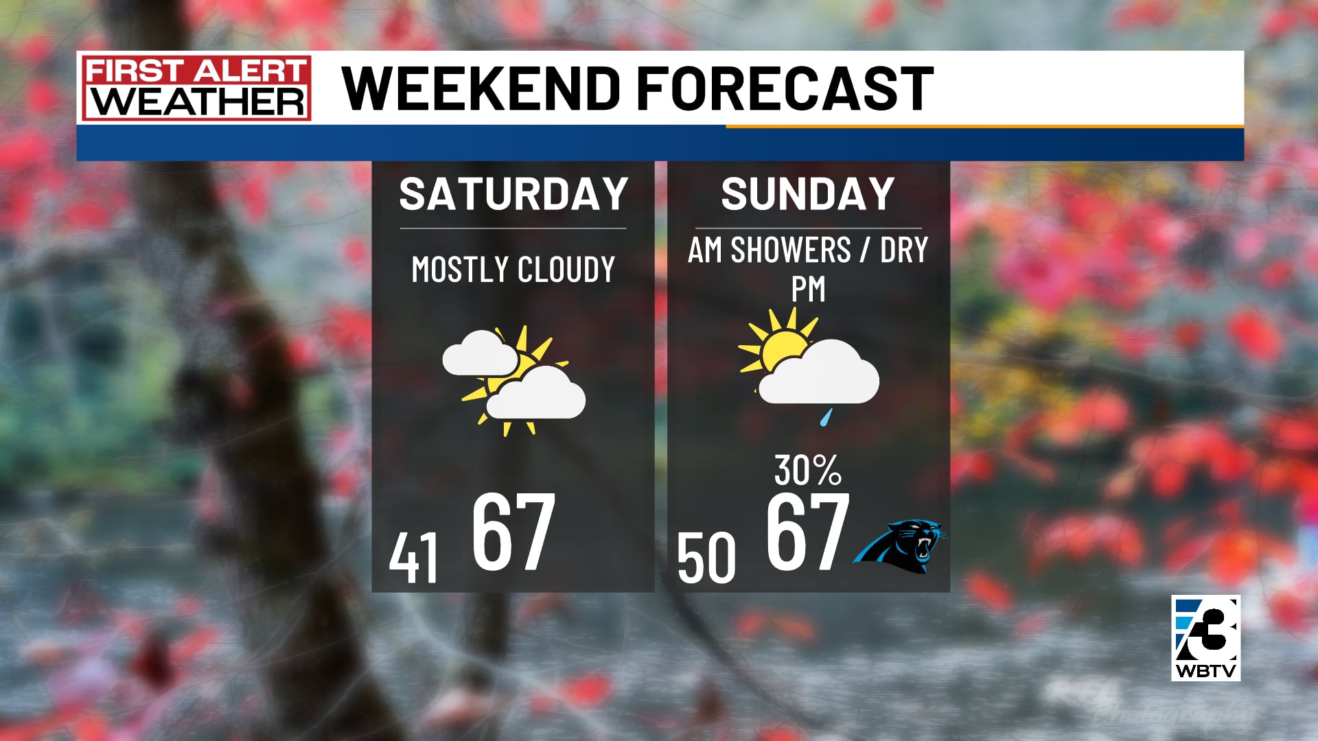
Over the weekend, an area of low pressure that is currently developing off the coast of Florida will begin to drift north, bringing chances for showers in the Carolinas.
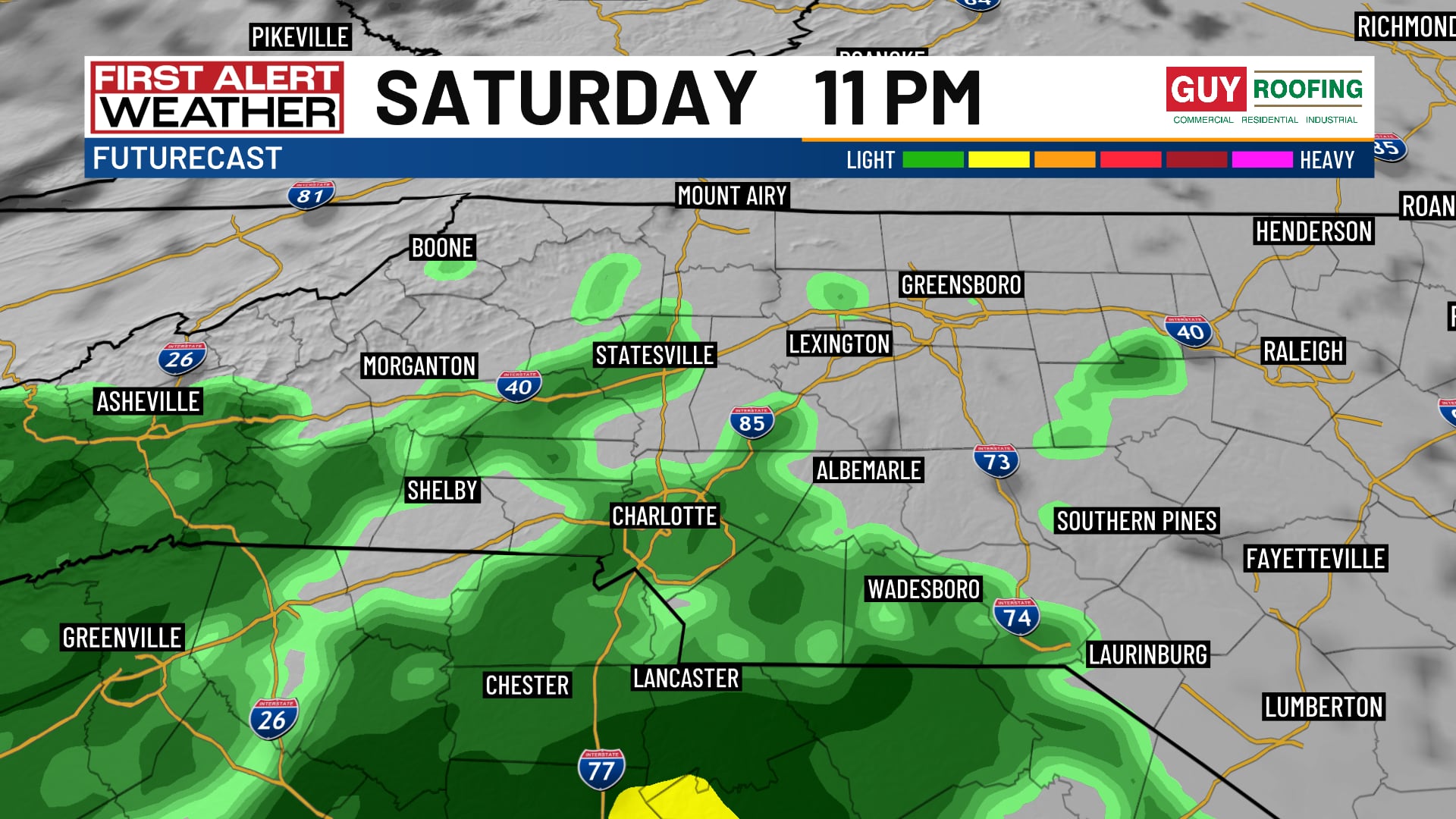
If the low tracks farther to the west, measurable amounts of rainfall can be expected in Charlotte, but if the low tracks farther east, only a few scattered showers will be possible along with some gusty winds.
Highs on Saturday and Sunday will top out in the upper 60s.
Sunshine returns on Monday
Sunshine will return by Monday along with more above-normal temperatures in the 70s. After Monday, a strong cold front will begin moving through the Carolinas.
On Tuesday, a stray shower is possible; otherwise, expect partly cloudy skies with much cooler highs in the 50s.
Wednesday looks chilly and wet for now, but Thanksgiving Day looks mainly dry; expect highs in the 40s and 50s.
Forecast at a glance
- Rest of Thursday: Increasing clouds, mild afternoon
- Friday: Sun & cloud mix, mild
- Weekend Outlook: Shower chances, mild afternoons
Download the free WBTV Weather app on your mobile device to get weather alerts and the latest forecast on the go. You can also catch the latest forecast on WBTV’s streaming app -- find it in the app store on your smart TV or streaming device.
Ver nota original ↗
¿Querés un resumen rápido de esta noticia, hecho por nuestra IA?