What historic El Niño could mean for winter in the Philadelphia region | Winter Weather Outlook
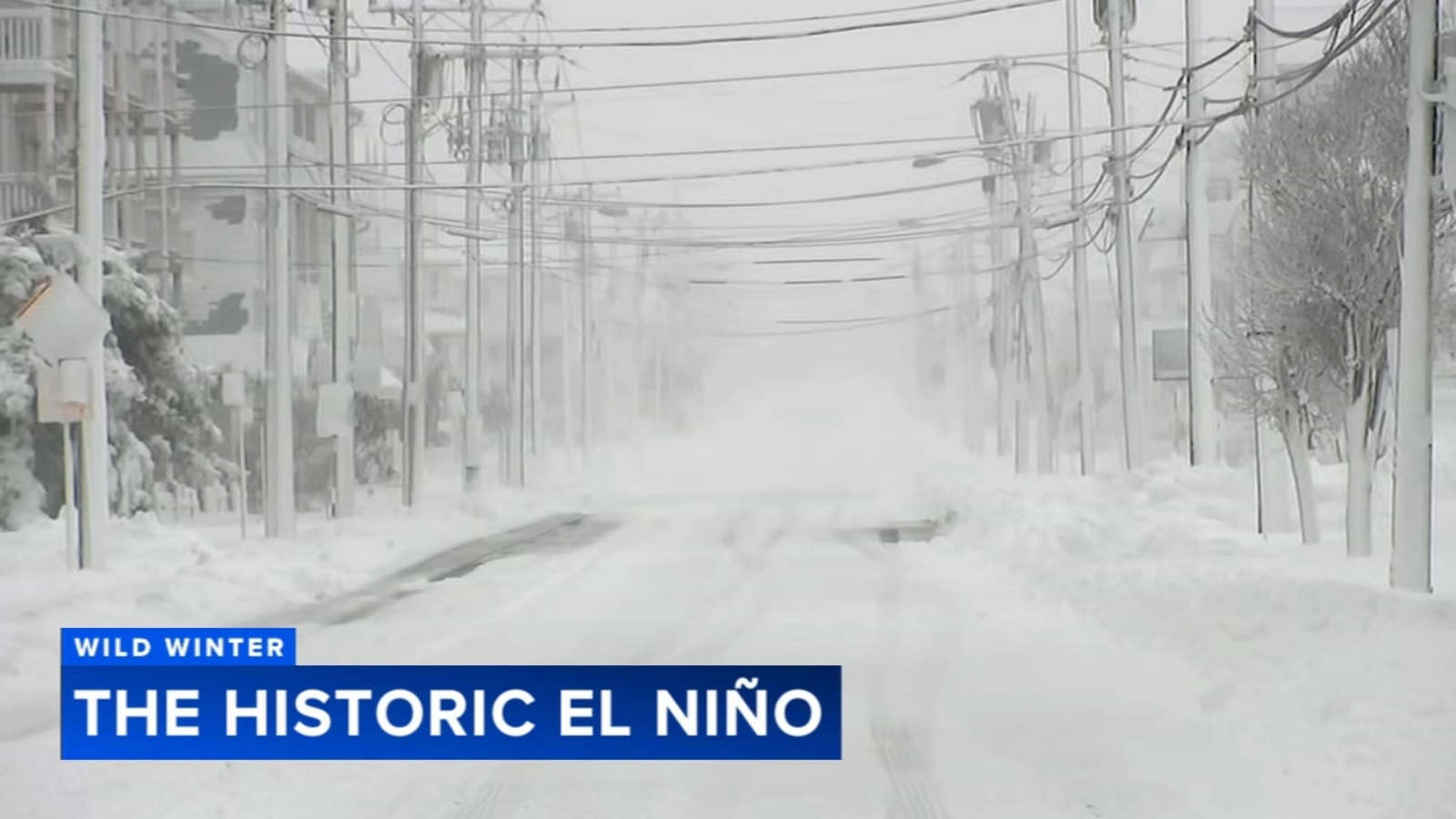
PHILADELPHIA (WPVI) -- The harsh conditions of last winter remain fresh in everyone's mind.
It was consistently cold, with a layer of snow and ice on the ground for over a month. In the end, we had over 30 inches of snow.
This year is looking very different. The La Niña pattern has transitioned to an El Niño, and not just any El Niño, but one for the record books!
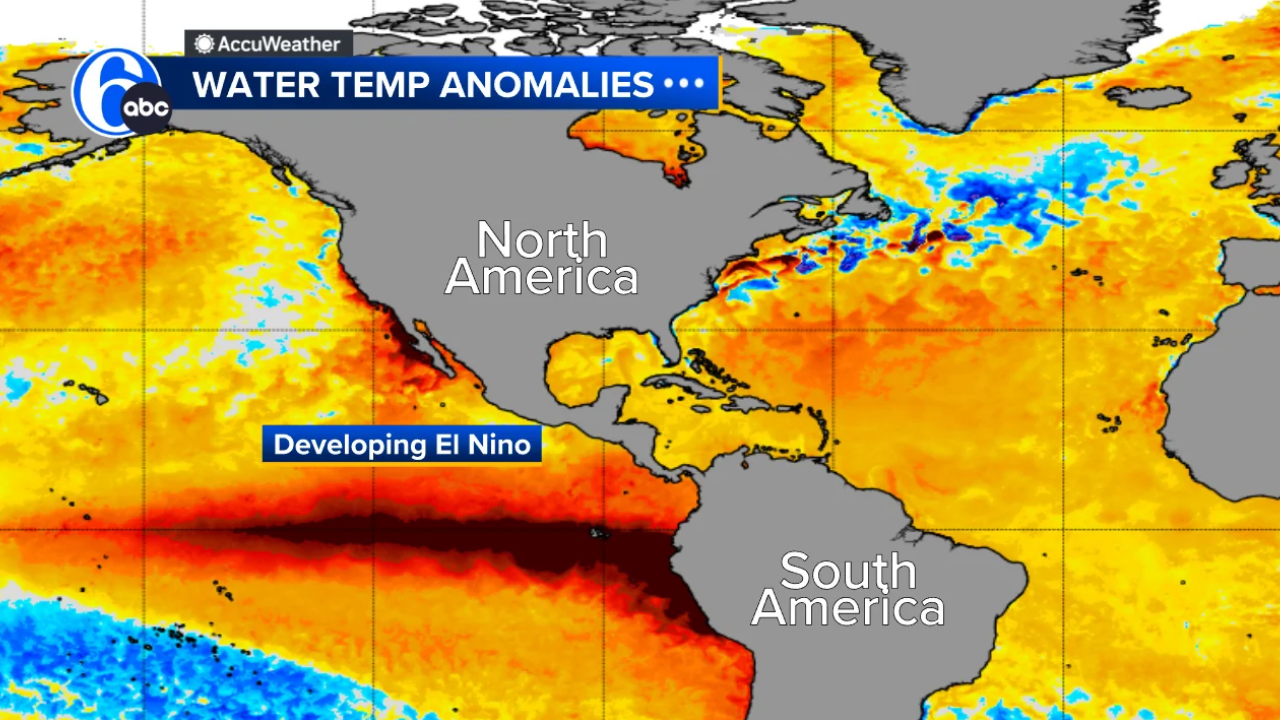
The telltale sign is warming waters in the equatorial Pacific off the coast of South America. These deep reds indicate temperatures near 10 degrees above average, warmer than it ever has been in history. This alters the entire global circulation and weather patterns even beyond winter.
"For North America, the expectation is for some very serious flooding and extremes to happen anywhere from, let's say, California — we've already seen the Southwest being hit — to the Southeast and even the Mid-Atlantic coast. And then following into the spring and summer, these water temperature anomalies could be insane going into next summer," said AccuWeather Senior Meteorologist Paul Pastelok.
This very strong El Niño, only the fourth time to happen in 76 years, means the polar jet stays well to our north, limiting the amount of Arctic air. It also means an active subtropical jet aims into California and across the southern U.S.storms can then keep going out to sea or turn up the East Coast. This makes for above-average temperatures across the northern states.
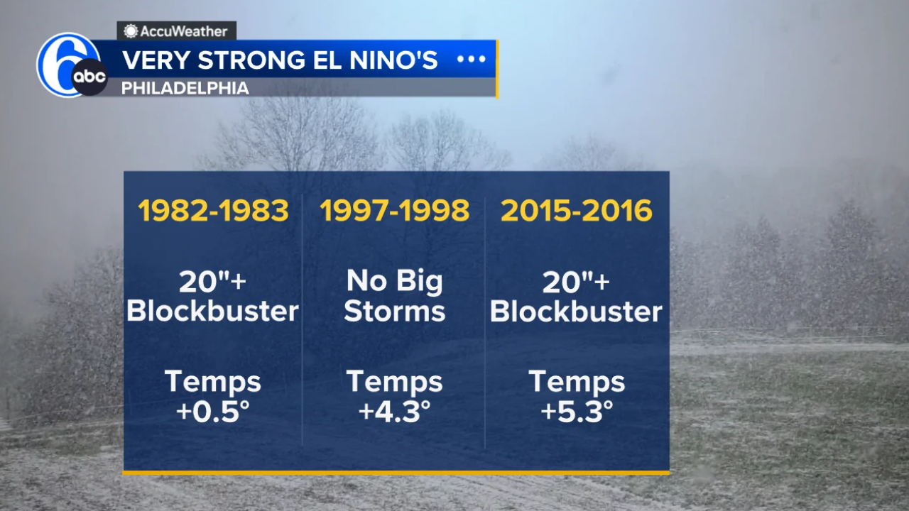
When we compare this setup to similar strong El Niño winters, the chances of having one blockbuster snowstorm are high, like in 1982-83 and again in 2015-2016. However, it is not a slam dunk. In 1997-98, that winter season had no snowstorms. It comes down to perfect timing, getting the limited cold air linked with a storm in what is an overall mild pattern.
So what does it mean for us inland versus the coast? Though it is only November, our shoreline has already been severely tested by multiple coastal storms. The fragile coastline looks more like mini cliffs, leaving it highly vulnerable to future erosion.
With a historic El Niño forecasted this winter, coastal storms are expected to continue, keeping local residents and officials on high alert.
North Wildwood Mayor Salvatore Zampirri and other shore mayors are in talks with the Army Corps of Engineers and the DEP to figure out solutions like extending dunes and bulkheads in addition to beach replenishment.
So, while the active storm track targets our broken-down dune system, it could also have great impacts inland.
A warmer, more active winter means threats of heavy rain and flooding for the Delaware Valley. Folks living along waterways will need to be on alert. Much of the time, heavy coats and shovels won't be needed, but umbrellas will be.
Past strong El Niños have proven this theory. The previous two strong El Niño winters saw above-average precipitation with nearly a foot of liquid.
For snow lovers, sit back and have some patience.
"With these El Niños, it takes some time. January 20th seems like the magic date. Anytime after that, we start to see things rolling for some places to get just 1 inch of snow," said Pastelok.
Copyright © 2026 WPVI-TV. All Rights Reserved.
Ver nota original ↗
¿Querés un resumen rápido de esta noticia, hecho por nuestra IA?