Rain in Charlotte becoming more likely this weekend amid uncertain forecast
CHARLOTTE, N.C. (WBTV) - All eyes are focused on a developing storm system that will track up the Atlantic coast this weekend.
The system will bring heavy rain, gusty winds and high surf to the coast, but the extent of inland impacts are less certain.
Latest on weekend rain chances
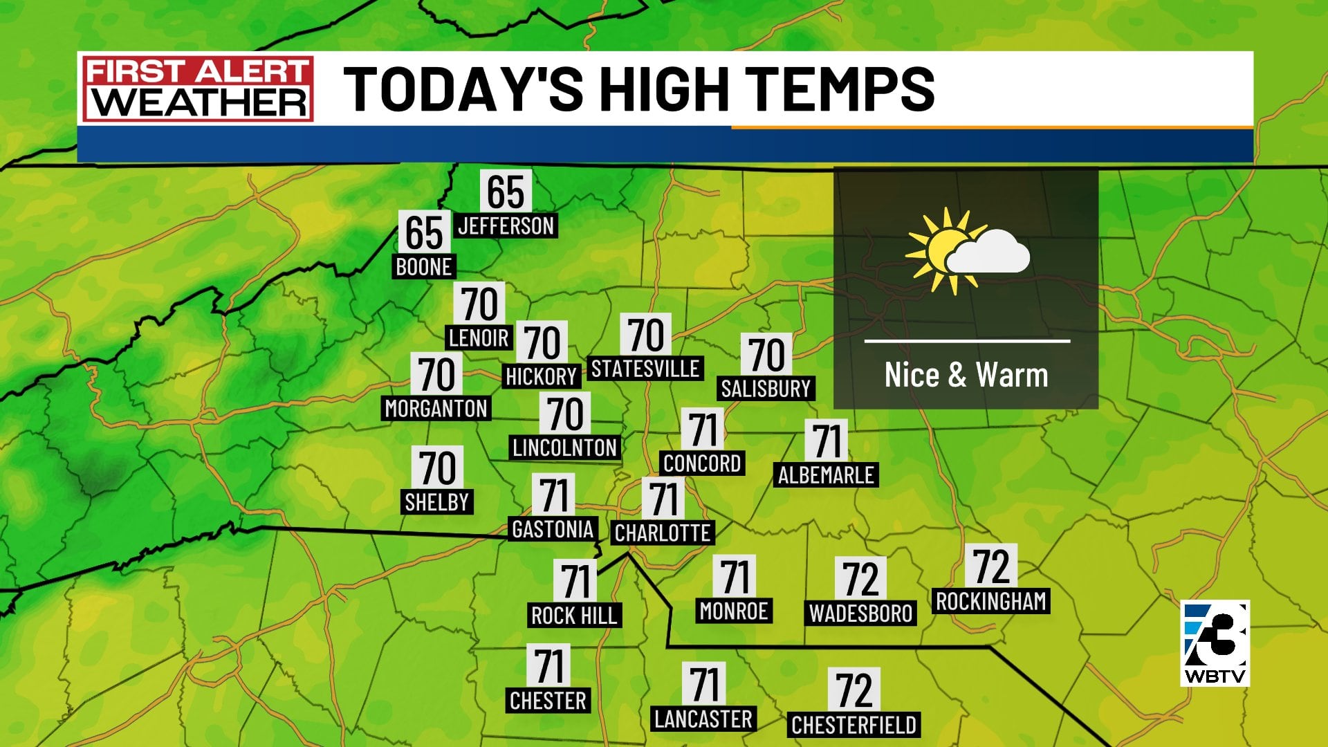
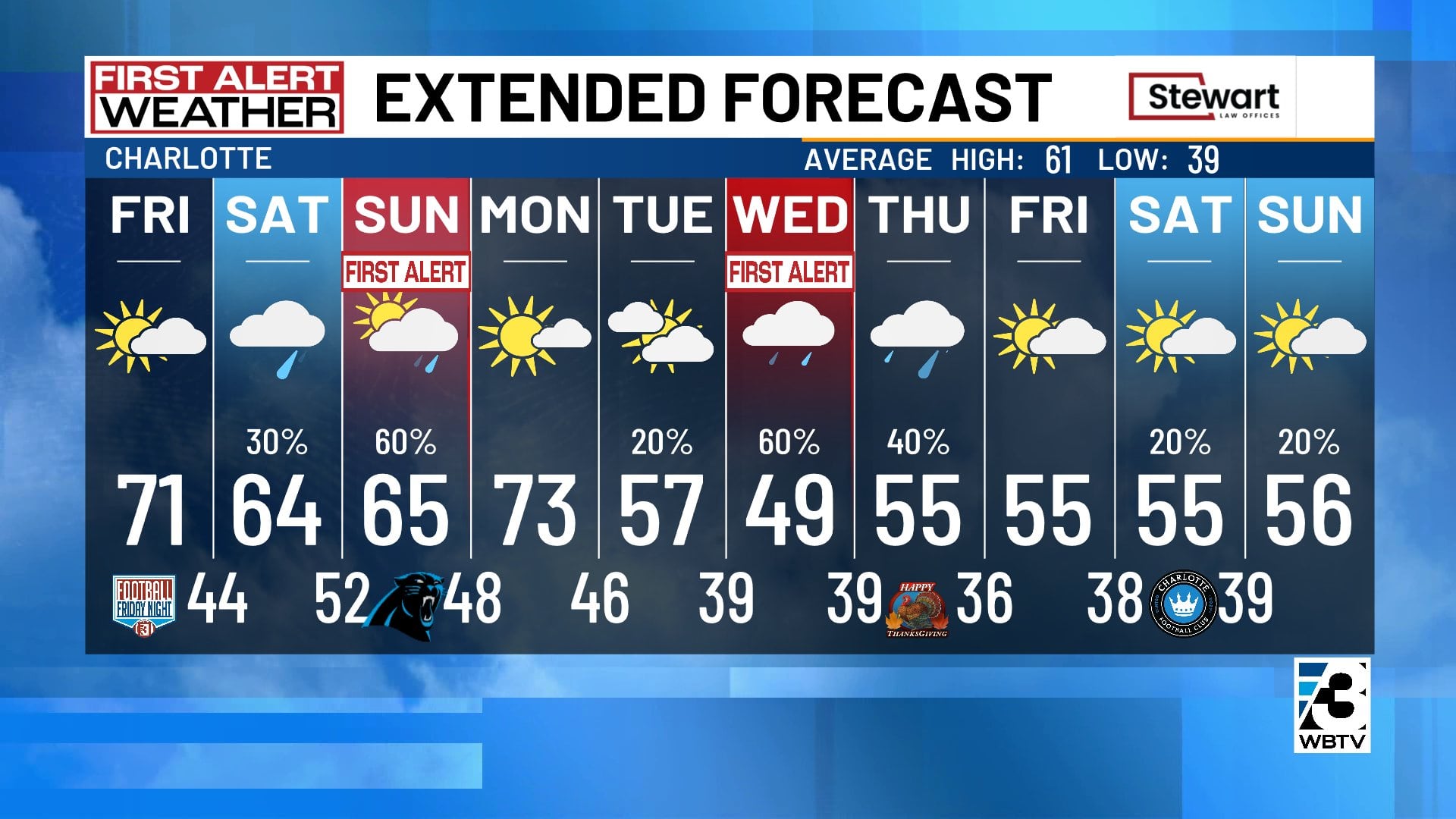
Friday will be a nice, warm day with afternoon readings reaching the low 70s around Charlotte -- about 10 degrees above normal for mid-to-late November.
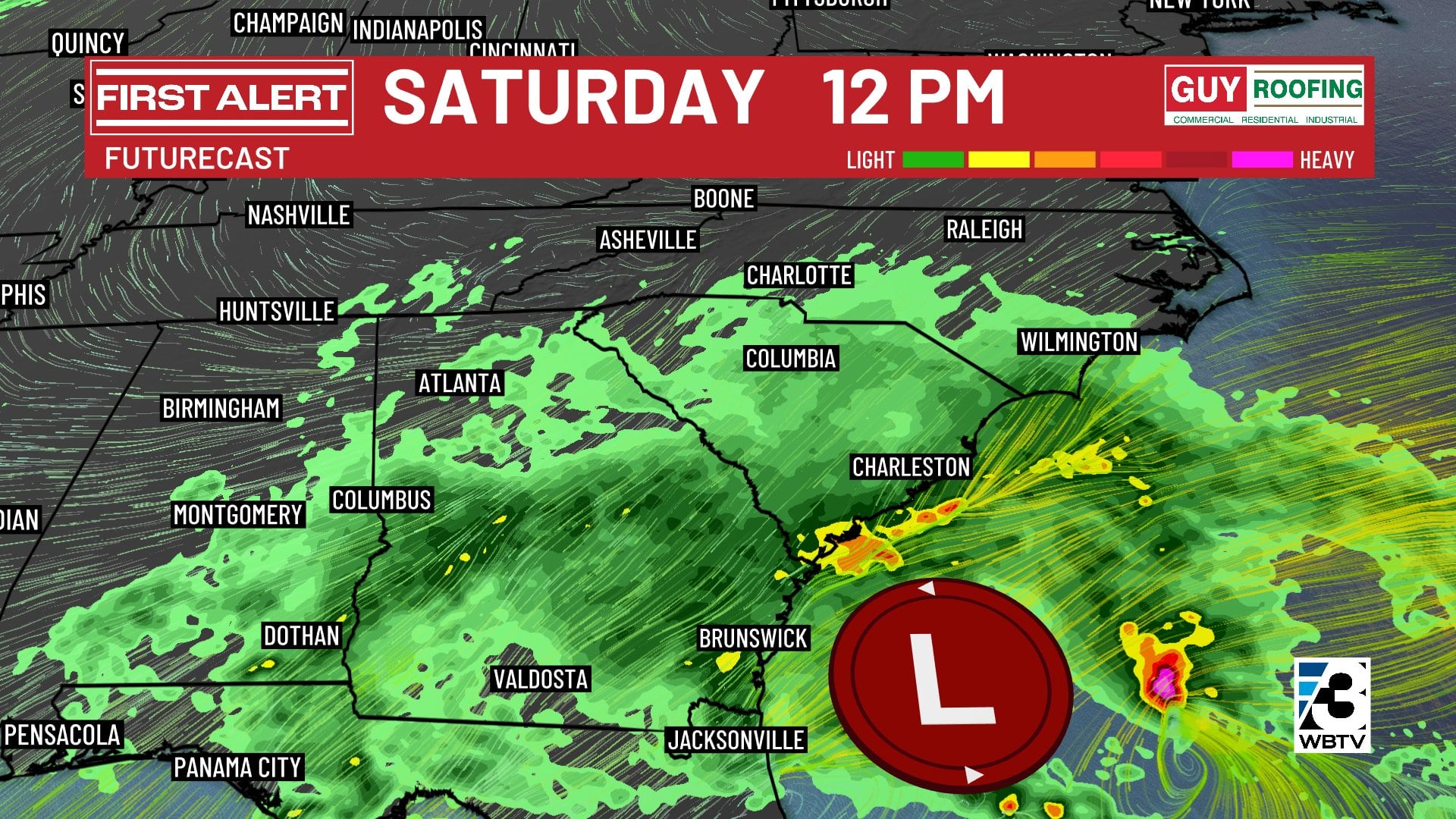
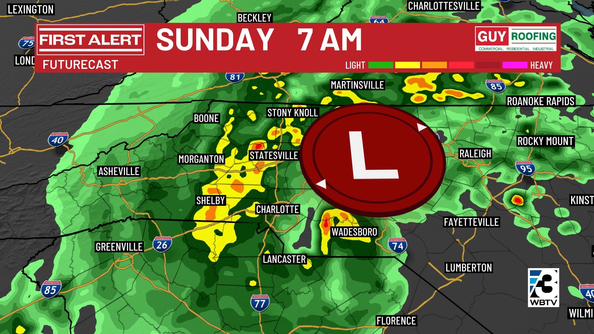
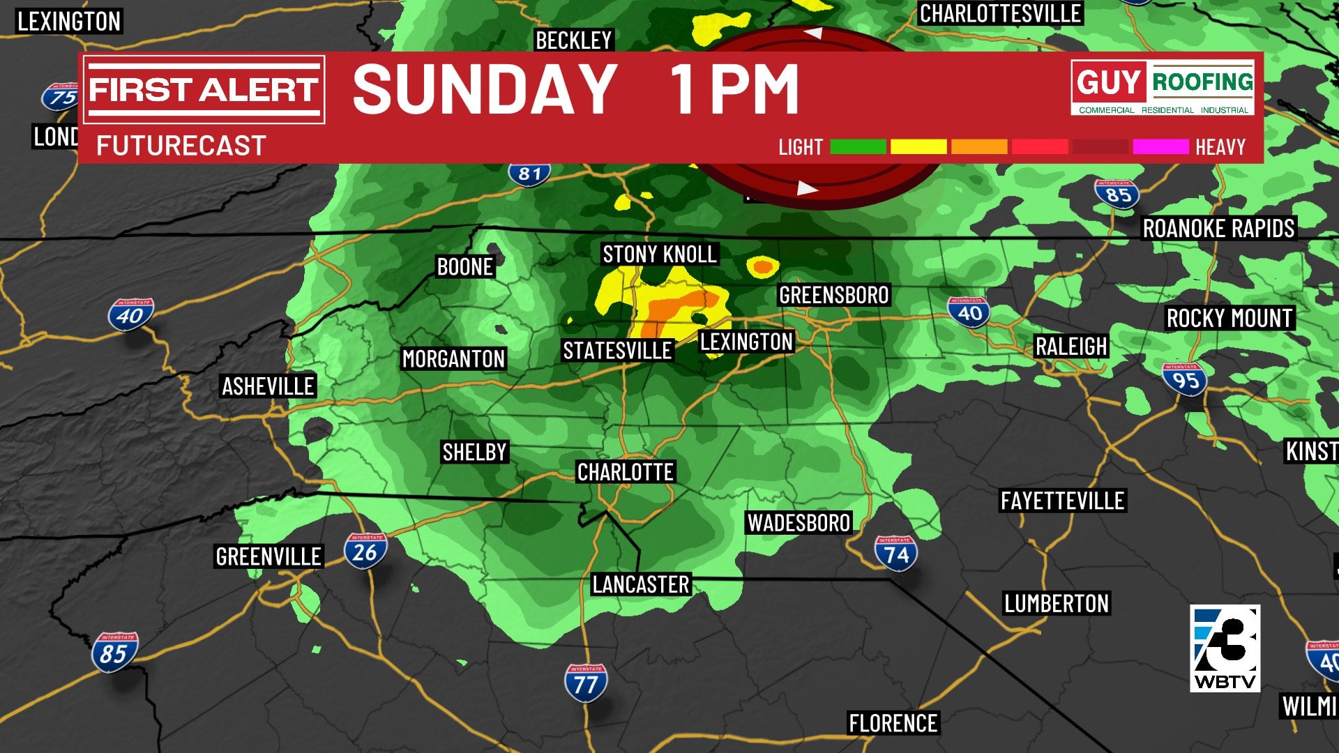
A still-developing coastal storm system will send moisture into the region Saturday afternoon through midday Sunday. The National Hurricane Center is estimating a 50% chance that the system becomes a sub-tropical storm (the next name on the list is Kyle).
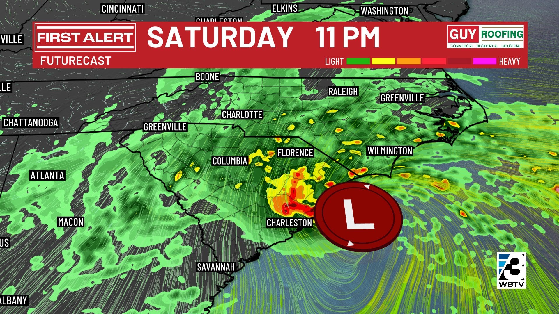
What we know: This coastal storm will have a major impact on the coast of the Carolinas. High surf, wind gusts over 50 mph, and 2+ inches of rain are likely along the immediate coastline.
What we’re still figuring out: The exact path of the storm system, which will determine how far inland the rain and wind will be impactful. The latest trend continues to push that path farther west, bringing the rain and wind deeper into the Carolinas.
For now, we are generally treating I-77 as the dividing line between high rain chances to the east (80%) and lower rain chances to the west (40%). It will be a sharp cutoff between rainy and dry weather, so even small changes to the forecast path will have large impacts on the forecast.
At this point, the best chance for rain in the Charlotte metro area looks to come Saturday PM and linger through midday Sunday.
As has been the case all week, forecast models are struggling with this one. Check back with the First Alert Weather team for updates.
Cooldown coming next week
Following the weekend, Monday looks warm and dry with highs in the lower 70s before much colder temperatures mainly in the 50s takeover for the rest of next week.
Long-range trends continue to point to increasing rain chances for pre-Thanksgiving travel on Wednesday, and showers could linger into Thanksgiving morning as well.
Yet another chance of rain will head our way for the post-Thanksgiving weekend, which also could impact travel across the region.
Forecast at a glance
- Friday: Sun and clouds, warm afternoon temps near 70 degrees
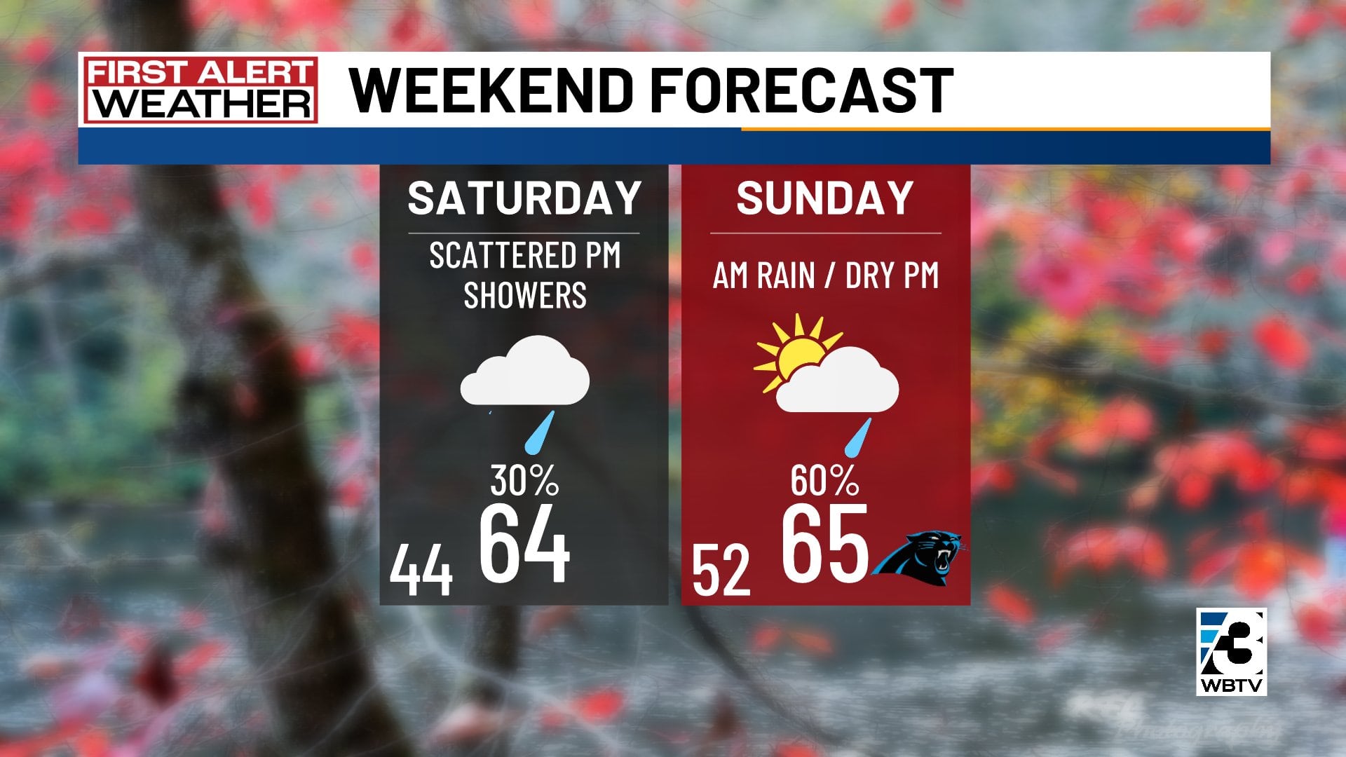
- Saturday: Mostly cloudy but dry until late day, mid-60s
- Sunday: Mostly cloudy, AM rain, dry PM, mid-60s
- Next week: Warm 70s Monday, chilly 50s rest of week
Download the free WBTV Weather app on your mobile device to get weather alerts and the latest forecast on the go. You can also catch the latest forecast on WBTV’s streaming app -- find it in the app store on your smart TV or streaming device.
Ver nota original ↗
¿Querés un resumen rápido de esta noticia, hecho por nuestra IA?